|
I really must consider myself very lucky to have traveled over 62,000 miles in 14 years and not have to take time off over multiple days due to an injury. Since January 2024, 178 days, Strava notes 208 rides taking 368 hours 24 minutes that covered 3,130 miles. Sunday morning when getting out of bed I noted stiffness in my right ankle. I thought that I had just slept in an awkward position. After lunch I announced that the ankle was stiff enough that I would not ride in the afternoon.  I could not determine a specific incident that caused such stiffness and decided to Google the phrase "stiff ankle." It did not appear as a typical sprained ankle because it was not swollen greatly. It was tender to the touch the area above the right of the ankle bone down the top of the foot. Moving my foot up and down caused pain. I needed to walk stiff legged and it was difficult to pivot or push off from the toes. I found comfort in the reclining deck chair on my porch which elevated my ankle. Ice was applied on and off through the afternoon. It was a good time reading and I enjoyed the shade with a comfortable breeze. I discovered that stiff ankles are pretty common in the morning and I can particularly understand that at my age. The causes usually are arthritis or tendonitis. The query response went on to say overuse was also a common cause, especially after long periods of strenuous exercise. I concluded that my injury was from the last ride. Riding the country roads for two and a half hours had probably caused the strain from overuse.  I am anxious to get on the road of recovery. When I am used to riding 1 or 2 hours each day, it is hard to stop. But I must take a break. Injuries do not go away. Riding and ignoring physical pain is not a remedy. Rest and ice can work wonders. RULE #1 LISTEN TO YOUR BODY. Through the second day there was considerable limping and discomfort. I spent the afternoon in bed with the foot elevated. By the third day the discomfort had almost disappeared and the ankle is feeling noticeably better. My spirits were lifting. This leads me to say, "Good, I can ride soon." If I push it too quickly, I may aggravate the injury. RULE #2 DON'T PUSH TOO HARD TOO QUICKLY I will see how it feels tomorrow. It may be good to do the inside trainer first. A half hour easy ride will probably be enough and it is easy to cut shorter. Going outside will put me further from home and harder to cut the ride shorter. Taking it day by day is the best plan. RULE #3 WHAT CAUSED THIS INJURY It is important to determine why the event happened, so you are less likely to make the same mistake. MY CONCLUSION A couple of weeks ago on a similar ride, I was wearing my hiking shoes instead of cycle shoes. After the ride the muscle along the side of my right calf ached. The pedals are old style metal pedals (rat traps) that came with the bike. I decided to use my cycling shoes this time. I think my pedals need to be a larger platform surface to provide more support. My foot was probably slipping off the pedal platform and put undo stress on a calf muscle. On my tours I have always used pedals with clips and I should use those on this bike too.  The diagram helped me to understand what muscle was the problem.
0 Comments
Each season I take some rides to explore different parts of Ann Arbor. The painting of bike lanes on roads has been happening over the last four years. There are many cyclists in the city and drivers are aware and courteous toward riders and pedestrians. The campus is much quieter during the summer. Today is a Sunday and I think those days have less traffic. Sunday also has more leisure riders and those doing their long rides for the week. I have done some seat of my pants exploring, but today I was looking for a direct route to the north end of town.   In the background you see a dam across the Huron River. There were many out on the trails. The residential roads were quiet. Ann Arbor has parks throughout the city and elementary schools have play fields. It is common to find these in use.  I went further north along the river. The track in the background is used by the Amtrak and freights.  A sculpture near the river. They look like old kayaks.  These clouds looked threatening. I wondered about getting a storm, but it did not even sprinkle.  Past the orange bouys people will tube down the rapids. Look for a photo for that later.  Interesting to find this in a parking lot next to the trail. I am glad that they kept this out. There are still two freight lines through Ann Arbor. The Amtrak comes through several times a day . The route goes between Detroit suburbs and downtown Chicago. I had a very enjoyable bike ride today.
 At the end of March I saw this on Facebook and I had never been to one of these. It interested me since I love bikes. I just wanted to check the place out. It was only a short drive to get there and I decided to get there about a half hour after it opened.  There were many bikes set up. There were many bins of parts too. The setting was the county fairgrounds and there was plenty of space for people to set up. Numbers identified the spots to organize vendors, but for us there was no map. At the first stop I saw this black Schwinn Racer. This is very similar to my second bike. This was a three speed. Some readers may not remember such bike, but they were very popular in the 50's and 60's. Some called them an English three speed. Wow! When I do a search there are still a variety of 3 speed bikes available. For me they would be good as a flat commuter bike. I usually rode mine in the second gear. The low gear for going up a hill and the 3rd gear for adding speed down the hill.  The Schwinn Spitfire. This bike is very similar to the bike that I first had. It was red and a 24" bike. I eventually removed the fenders and bought a drop (racing) handlebar. I used this one until I was in the 6th grade when I got the 26" Schwinn Racer. If I would have left now my day was complete. These two bikes had such wonderful memories of riding around the neighborhood and town.  An ad like the ones I would see in my Boys' Life. I would see the ad and dream of getting the 10 speed. I was like Ralphie dreaming of his BB gun:) Schwinns were popular bikes when I was growing up. We considered them to be the top of the line. It was definitely the top of our line. This show had many Schwinn bikes in various conditions. There were some ready to ride and other would need some hard work. There were many components out. Do you need some parts for your old bike? I would not be surprised that you would find it here.  I had one of these on my bike. I want to see how far I went and how fast.  The pavilion had many treasures.  Interesting. There were many interesting items and shape looking renovated classic bikes. I would have liked to see the steam bike work. Several other buildings had vendor displays. I spent close to four hours exploring.  The fin design front fender of the Racer with an original tire. This event was worth the $6 entry fee. They even had a food trailer open. I was happy to see that.
This is my plan for rainy days, ride inside. I look at the weather prediction for the day and decide what I feel like doing. Our thunderstorms went through last night, but today there was on and off rain. This time of the year the temperature in a big deciding point. Today it was in the 60s and it is 69 degrees, so the temperature is perfect. I was in the mood to be inside and ride on the trainer. Yesterday was a wonderful day and I spent 3.5 hours on the country roads southeast of my home. While on the trainer I will watch bike riders adventures on YouTube. Please enjoy the places that I saw during the two hours in the saddle. I like to see places that I will never get a chance to ride. I go in 30 minute segments. It helps my body recover the static position by walking around. Between these two practices the two hours went fast. 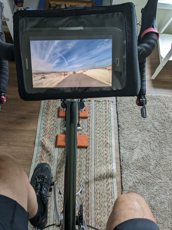 Bike trail near Henderson. This town is outside Las Vegas, NV. 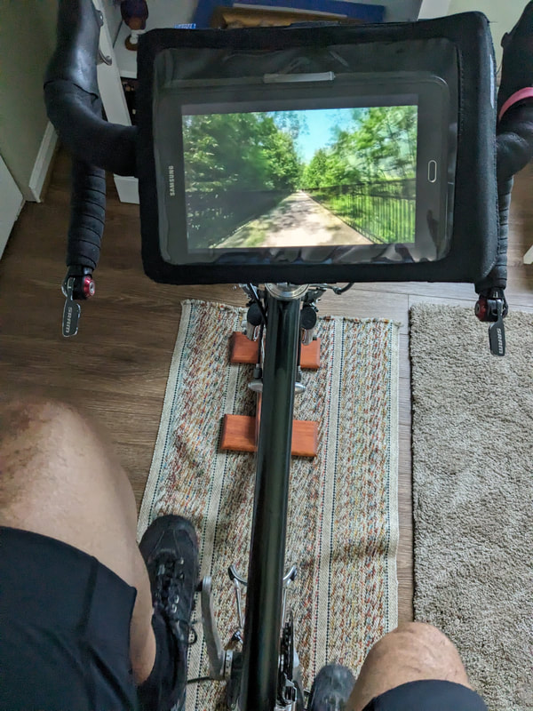 The trail going through Burlington, VT. 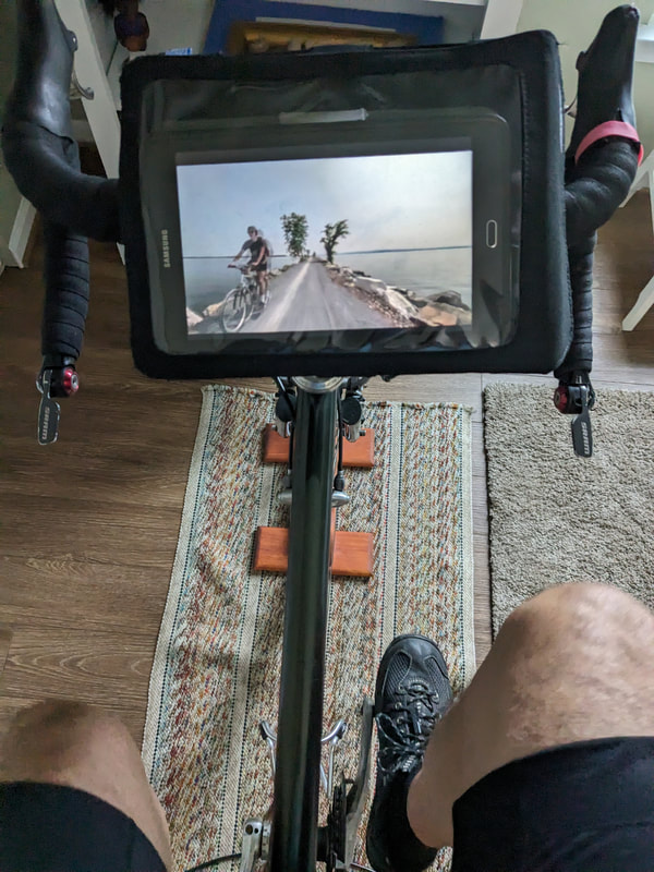 On the causeway in Lake Champlain on the way to the ferry. 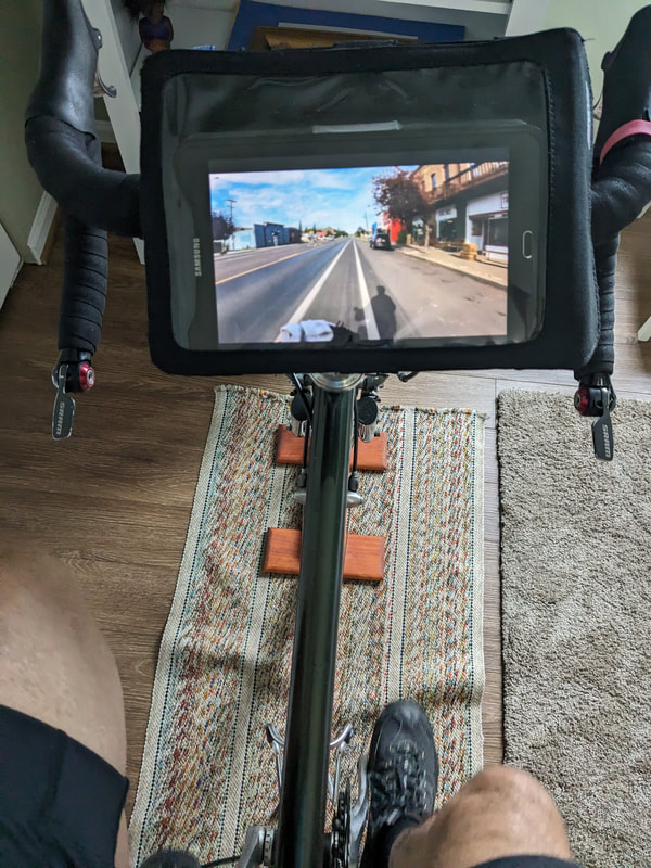 Biking through Del Norte, CO on the way to the Great Divide Mountain Bike Route. 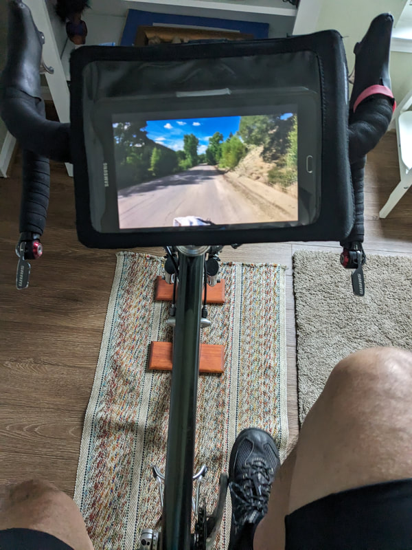 Going up the mountain to the Hoosier Pass at 11,542'.  White Rim Route. 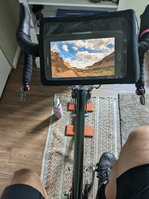 White Rim in Canyonlands National Park, Utah. On a tour I will ride in the rain. I always carry a poncho and I do not mind getting caught in the rain. I enjoy the selections on YouTube and this allowed me also to consistently train during the cold days.
I have not had many flats over 61,000 miles of riding in the last 13 years. All of those miles are with tires that use tubes. Being on the road and "old school" I still feel very confident in my tubes, but on today's ride I got a flat on the rear tire. Now I am thinking about flats and I better write about about it today. What do I take on my ride to deal with a possible flat? The first thing I ask myself. How much will I have to walk? Today I was planning a route that would take me about 10 miles from my car at the furthest point. I am looking forward to riding my bike, not taking a hike. How convenient is it to get picked up if I have a breakdown? Today, my wife was going to lunch with a friend. She is my dedicated rescue person. I try not to pull that card. I did it once in the last four years and I don't think that is too bad. Today meant that I would bring the following: tube, pump, tire levers. Once you realize that you have a flat tire, STOP! You do not want to cause rim damage. You also do not want to destroy the tire. OH NO! I have a flat. Take a look. What do you think is the cause of the flat? I could not see anything. Think for a minute or two. Weigh the options. I am about 2-3 miles from my car. I have the things I need to change the tire, but do I want to take the time. I even have the patches to fix a hole. I decided to see how well it was holding air. I got out my pump and filled it up and decided to head back to my car. My route was fairly smooth blacktop and level. Pay attention to what is happening during the ride. I stopped after about a mile because I could see that the tire was too low. I filled the tire again and went further. I covered about the same distance. I stopped. Looked my map to see how much further to the car and decided to pump up a third time. The last half mile was a walker path with deep wood chips and I knew this would be good for walking the bike with a totally flat tire. Repair the flat at home 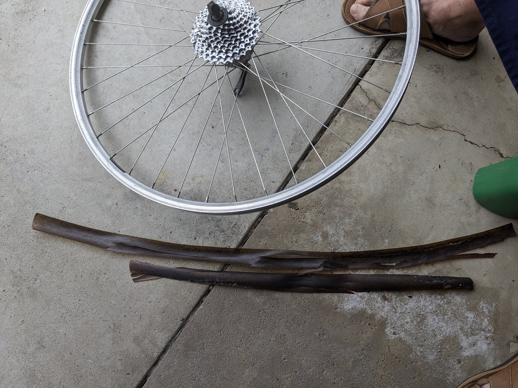 My tire liners helped protect my tubes for many years. These are now trash. The walk was not too bad and I made the correct decision for the situation. The tube was totally shot and the air quickly escaped whenever I pumped it full. If I was further away from home or the car, then I would have replaced the tube in the field. My new tire is holding air. I will see what it is like in the morning and take a test ride close to home, I want to be sure that I can count on this repair. Why didn't you use a patch? A new tube gives me more confidence than a patch repair. Finding a hole in a tube can take time. I keep a couple of tubes in my inventory. The patch is your plan B to get you home. I have used them and they work. I keep patches in my tool roll that I take on the rides. This tool roll also has a CO 2 cartridge for air in case I lose or forget the pump. Final thoughts. I always top off my tire pressure before each ride. When I was filling the rear tire today, it did not feel right because I could not get the pressure up after a certain point. I bet there was already a hole. I will be sensitive to that sort of feeling in the future.
If you have not changed a tube before then practice it at home. Repair practice at home is always less stressful. The first time I replaced a tube on the road, it was a disaster. I needed to call my son to pick me up because I was 15 miles from home. Be prepared for the unexpected. That is why you bring a phone with you and why I learned about dropping a pin to show my location. Photos of this trail with tunnels and trestles always caught my attention and lead me to want to bike there. A friend told me that he went on a Roads Scholar trip on this trail and others in the area. I am concerned with my ability to handle the elevation. I might be able to do it with an e-bike, but I am not sure. During a trainer ride last week I followed along on a YouTube video that someone did. 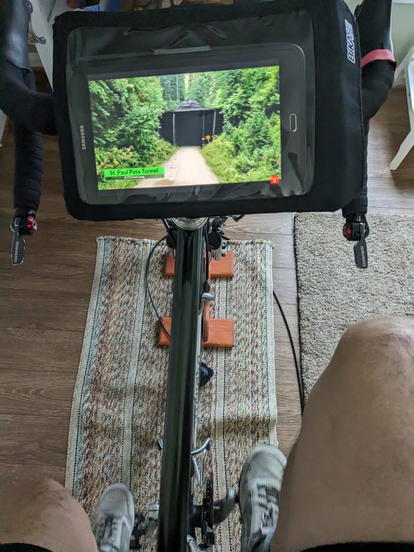 The first tunnel was closed for safety reasons. Okay, I am good with that. 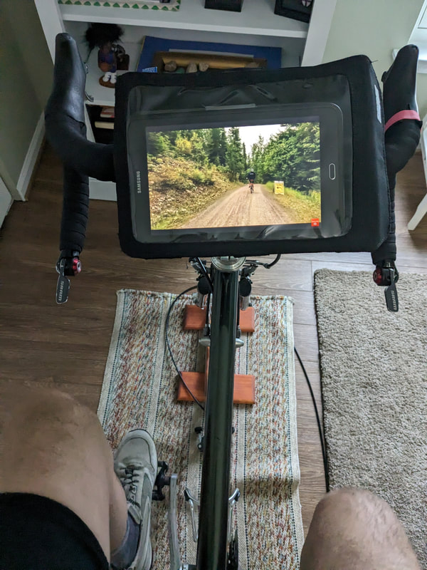 Railroad grades are good for me to ride, the elevation is 2188'. I could probably handle it. 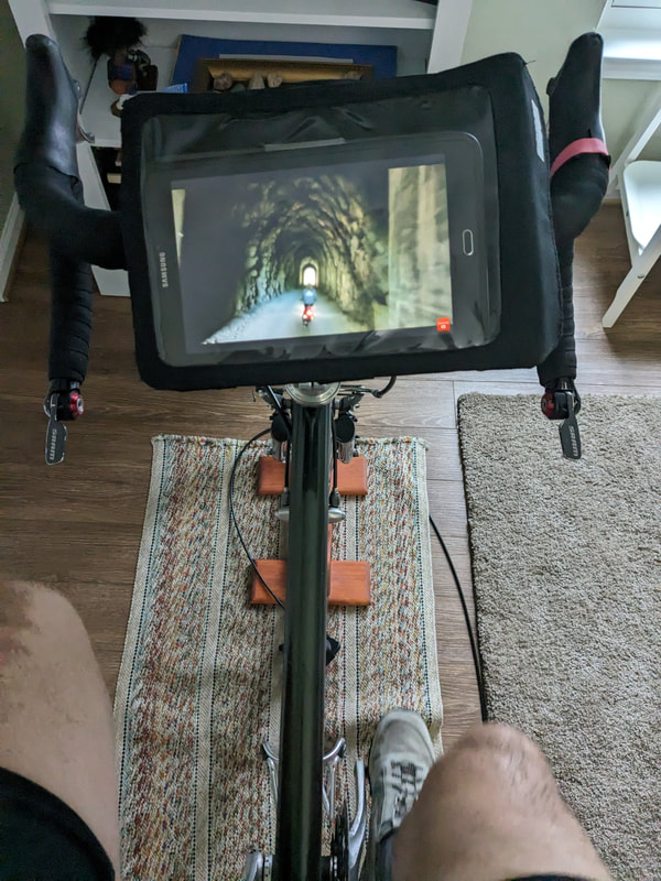 These tunnels are longer than what I am used to. Bring a headlamp. 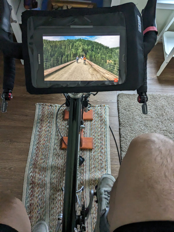 A nice wide path to stop to take a photo and enjoy the pine forest. 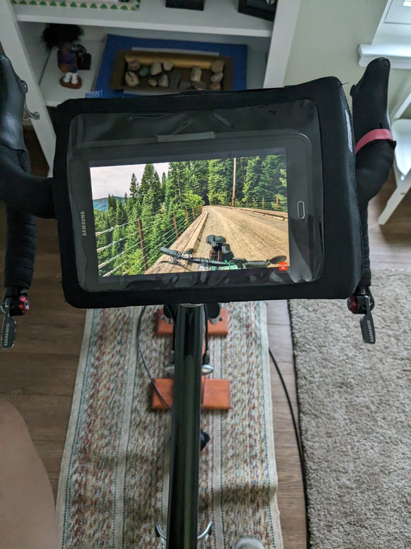 There is a fee to ride the trail and there are shuttles to take you back to your car. There are several videos of riders doing the trail. I enjoyed this ride and I will look further into this trip through Road Scholar. 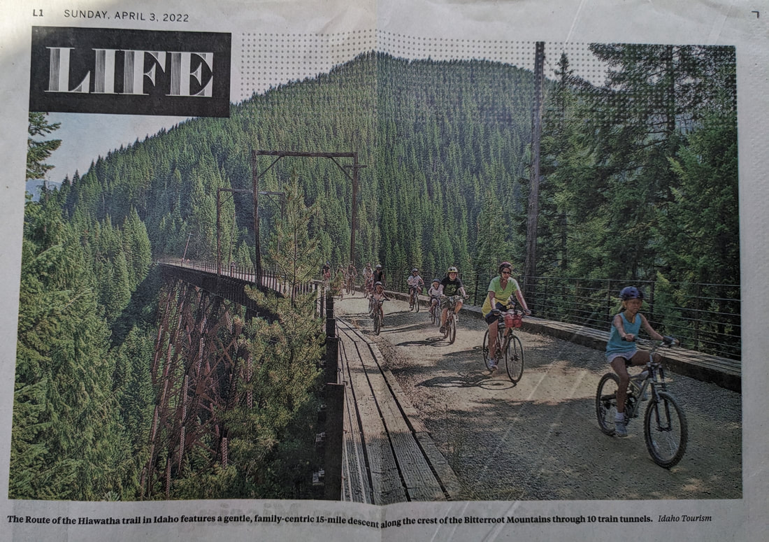  |
AuthorI love my riding days and look to find interesting and informative items to share. 
Archives
October 2023
Categories
All
Pacific Coast Highway
MUP |
 RSS Feed