|
During the 116 miles ridden in this segment I traveled through the towns of: Looe, Seaton Torpoint, Plymouth, Ivybridge, Tingley, Totnes, Teignmouth, Kenton, Clyst St. Mary, Newton Poppleford, Sidford, Colyford, Lyme Regis, and Chideock, You can find places to eat, sights to see and accomodations. 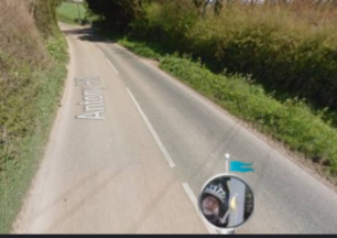 Loving the quiet road away from the traffic. 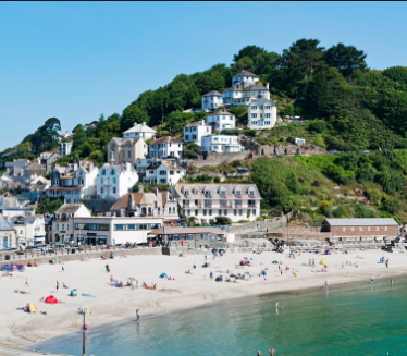 The village of Looe. The sandy beach is inviting during the summer. In the winter we see just the walkers. 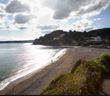 Another little village, Seaton, along the shore. These are also big commercial fishing 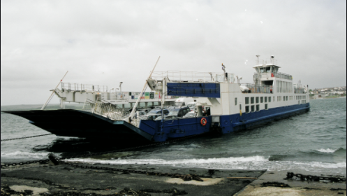 Torpoint is a planned city on a peninsula from the 18th century. A ferry goes across to Plymouth. The Royal Navy has a spot here. 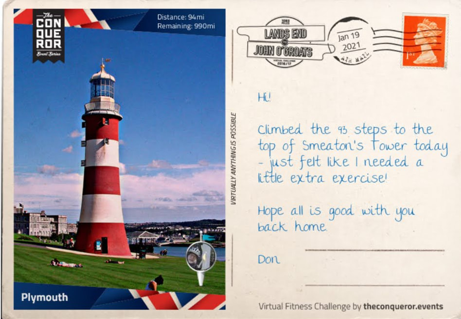 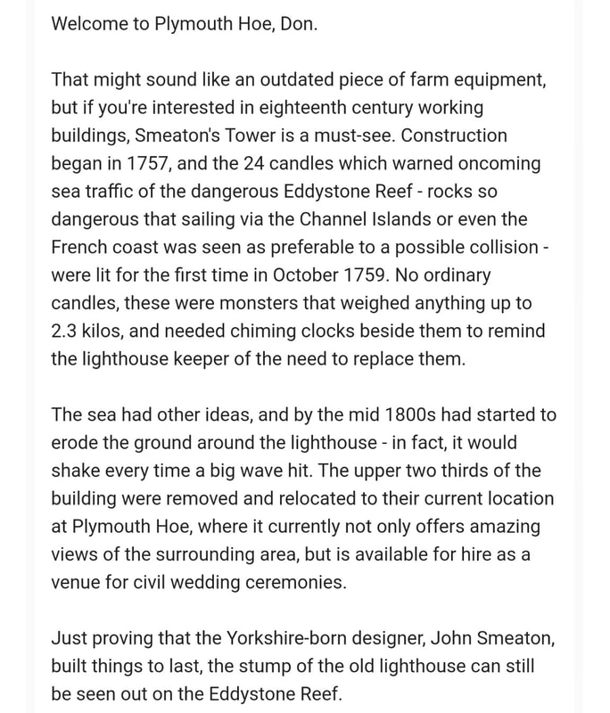 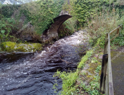 Path along the River Erme and I see the bridge covered by ivy near the town of Ivybridge. 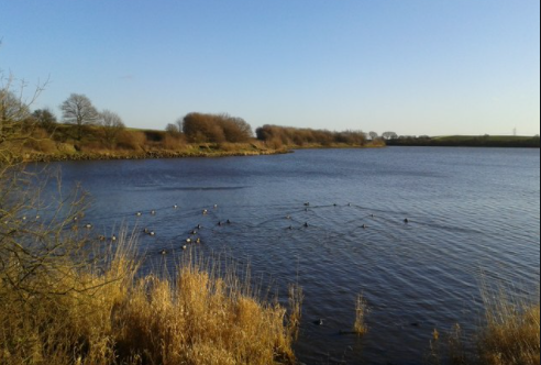 Near Tingley I see the Ardsley Resevoir. 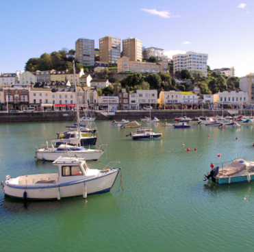 I move out near the sea to Teignmouth, a large seaside fishing port. 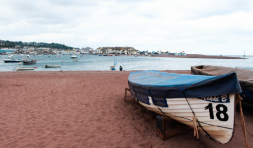 This is a good spot to vacation during the warmer weather. 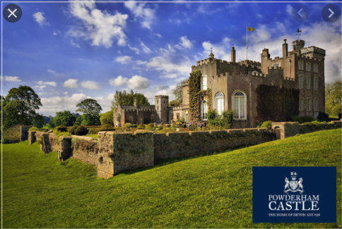 The village of Kenton has a castle. I will travel through several towns a day. I am averaging about 20 miles a ride. 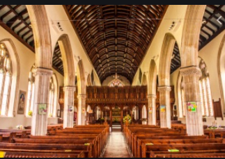 Every town or village will have a church. This is in Kenton. 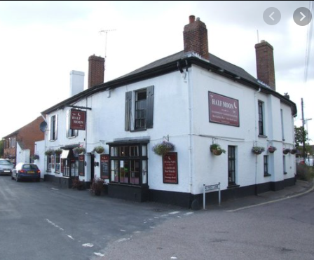 The Half Moon Inn in Clyst St. Mary. Clyst is a Celtic word for "clear stream." 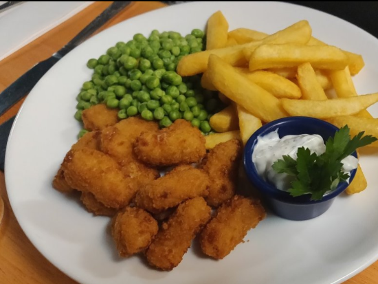 This virtual meal just does not make it. Our indoor restaurant dining in Michigan is not open until tomorrow. 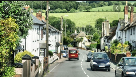 The street through Newton Poppleford which was founded in 1331. I bet many of the surrounding villages were from the same age. 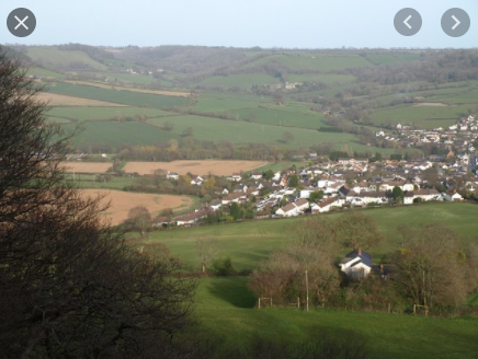 We are looking down to the village of Sidford. It lies 3.7 miles from the town I just went through and it will be 8.4 miles to the next town. 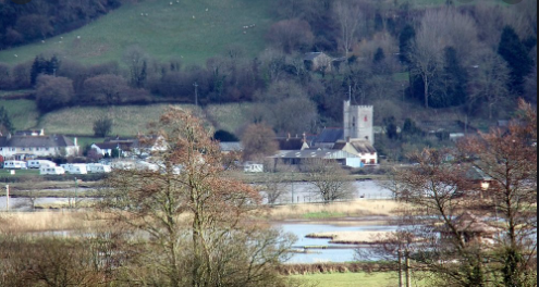 Approaching the village Colyford. 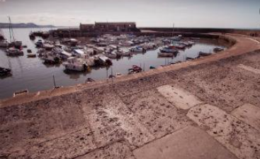 The harbor wall in Lyme Regis is called the Cobb and it is quite well known. It is mentioned in some classic literature. 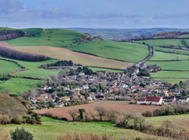 Cycling in a bit from the English Channel I come upon Chideock. 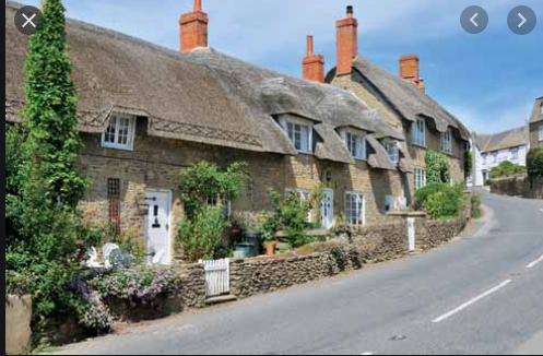 The village of Burton Bradstock Like many of the villages, Burton Bradstock, had a parish church, two pubs, primary school, shop, post office, beach cafe, hotel, garage, village hall, and reading room in the library. That sounds complete.
0 Comments
This is a virtual tour due to travel restrictions resulting from the Covid-19 pandemic. I find that these imaginary tours provide great motivation to workout inside because the temperatures are too cold for me to ride outside. I also enjoy learning about an area new where I have not traveled. 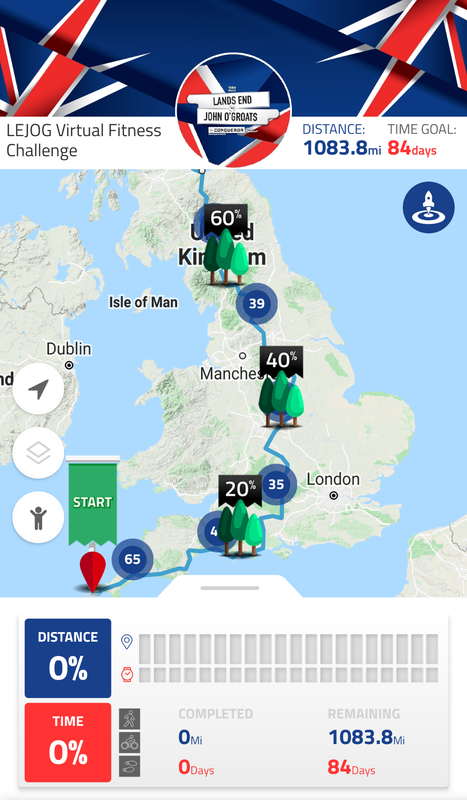 I decided to be conservative and allow myself 84 days to the over 1000 miles. Right now I am planning on about 20 mile rides. 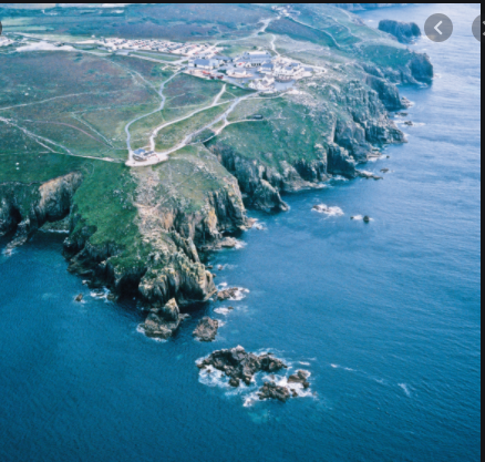 I can see how Land's End got its name. 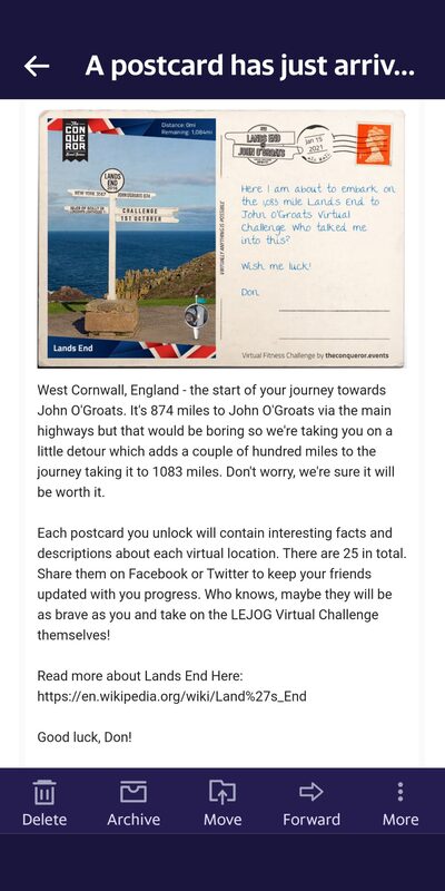 I checked out the link listed above and found how much I did not know about Cornwall and Cornish people, a Celtic ethnic group and a minority in the country. I have a lot to learn. 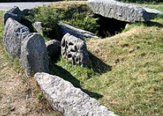 Tregiffian Burial Chamber from about 1900 B.C.  Penzance is a vacation spot, like other places around. I wonder is there were pirates here. I'll ask Gilbert and Sullivan. 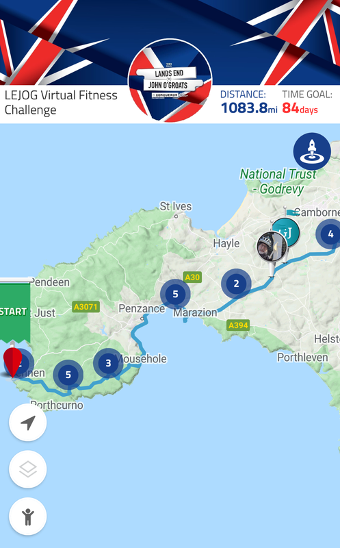 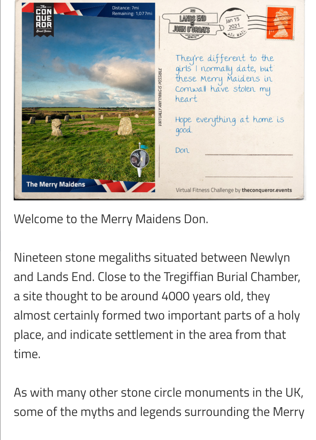  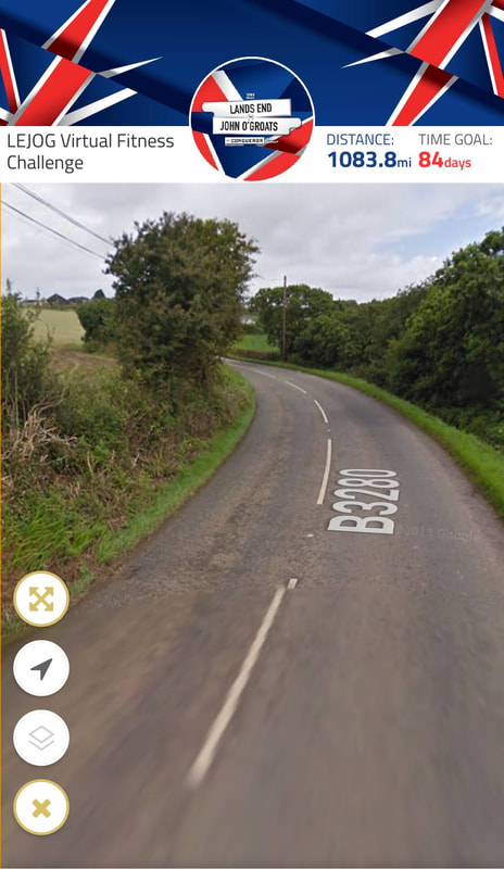 I am still working on remembering to ride on the left side of the road. Drivers were polite on these country roads. 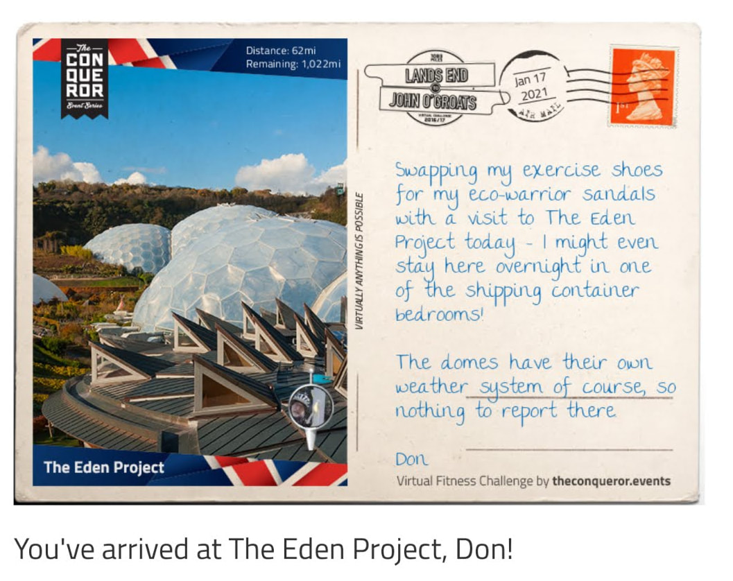  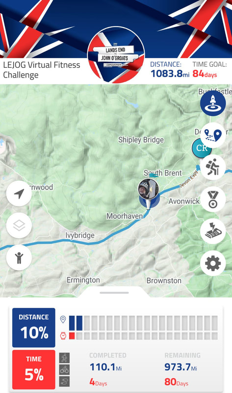 Passing through many small towns and easy to get food, supplies and lodging. Many travel along this route and you can meet many travelers. 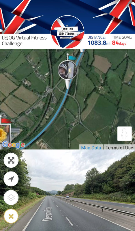 I have traveled over 100 miles so far. For many years I had hoped to do this ride. This virtual journey is outlines my route. When I do the ride, I now have a good guide. The route totals over 1200 miles. 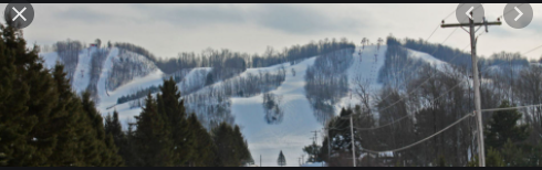 The mountains have now developed great skiing areas. Blackjack, Big Powder and Indianhead. 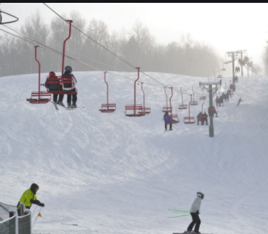 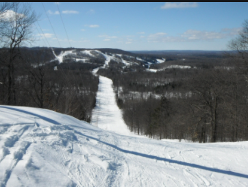 Now I am moving on to the United Kingdom to do the Conqueror Challenge of Land's End to John O'Groats. This will be over a 1000 mile tour. Please join me.
 Ontonagon is at the mouth of the Ontonagon River at Lake Superior. 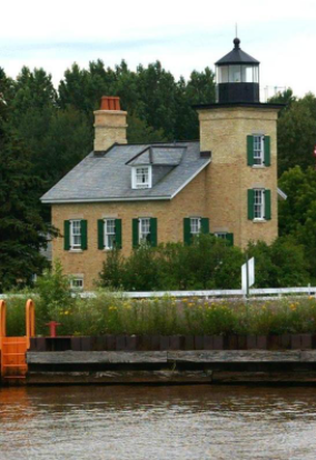 Ontonagon Lightouse is now on the National Register of Historical Places. As ship traffic increased on Lake Superior lighthouses became more important. In 1847 this was commissioned. 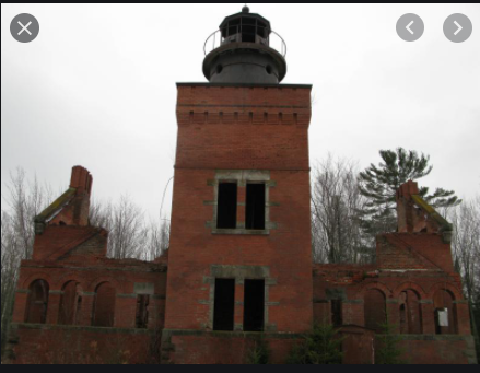 Part way between Houghton and Ontonagon another lighthouse was needed. This was called the Fourteen Mile Point. It was built in 1890 and was in service for 50 years. In 1984 a fire gutted the building and I see it is for sale for $795,000 with surrounding acreage. Have you ever thought of living in a lighthouse. 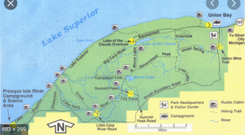 Porcupine Mountain Wilderness State Park. 60,000 acres makes it the State's largest . Ninety miles of hiking trails. 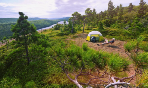 What a nice spot to set up the tent. 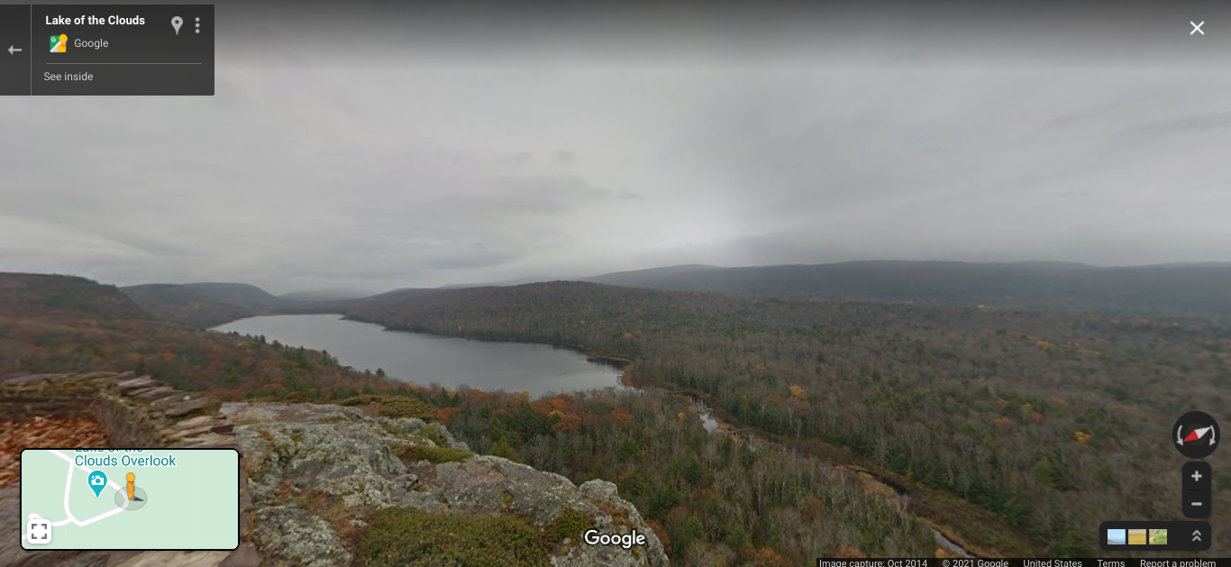 The Lake in the Clouds. 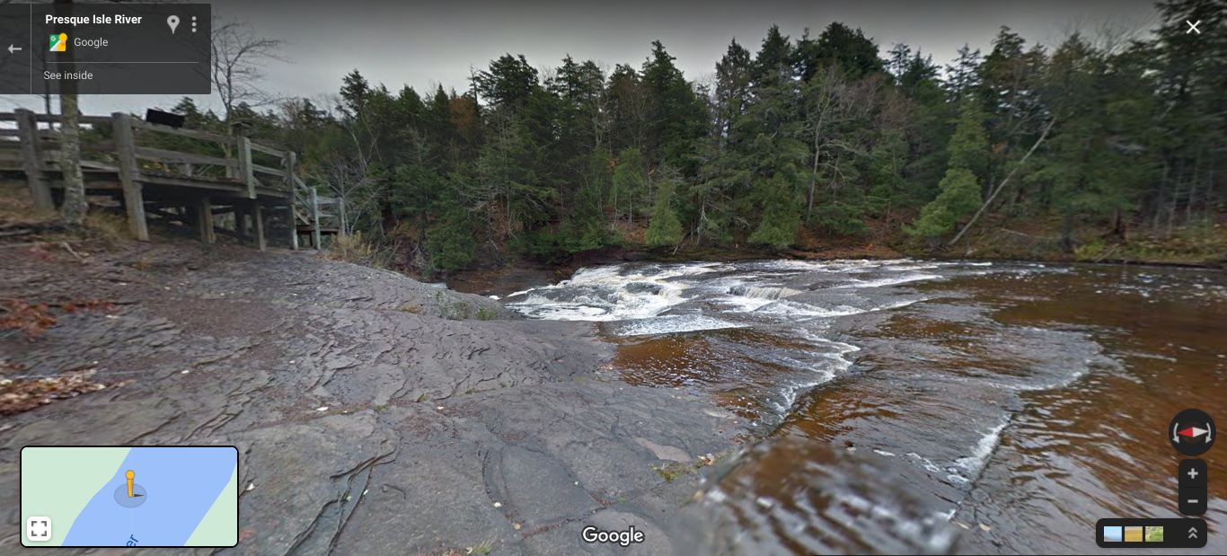 Presque Isle River Corridor. 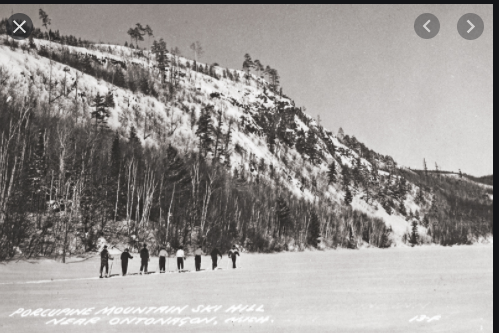 Cross country skiing and snowshoeing are popular too. In the 1840 the copper rush started and this area built up from the boom. The area is recreational now and you will see places vacated for many years. 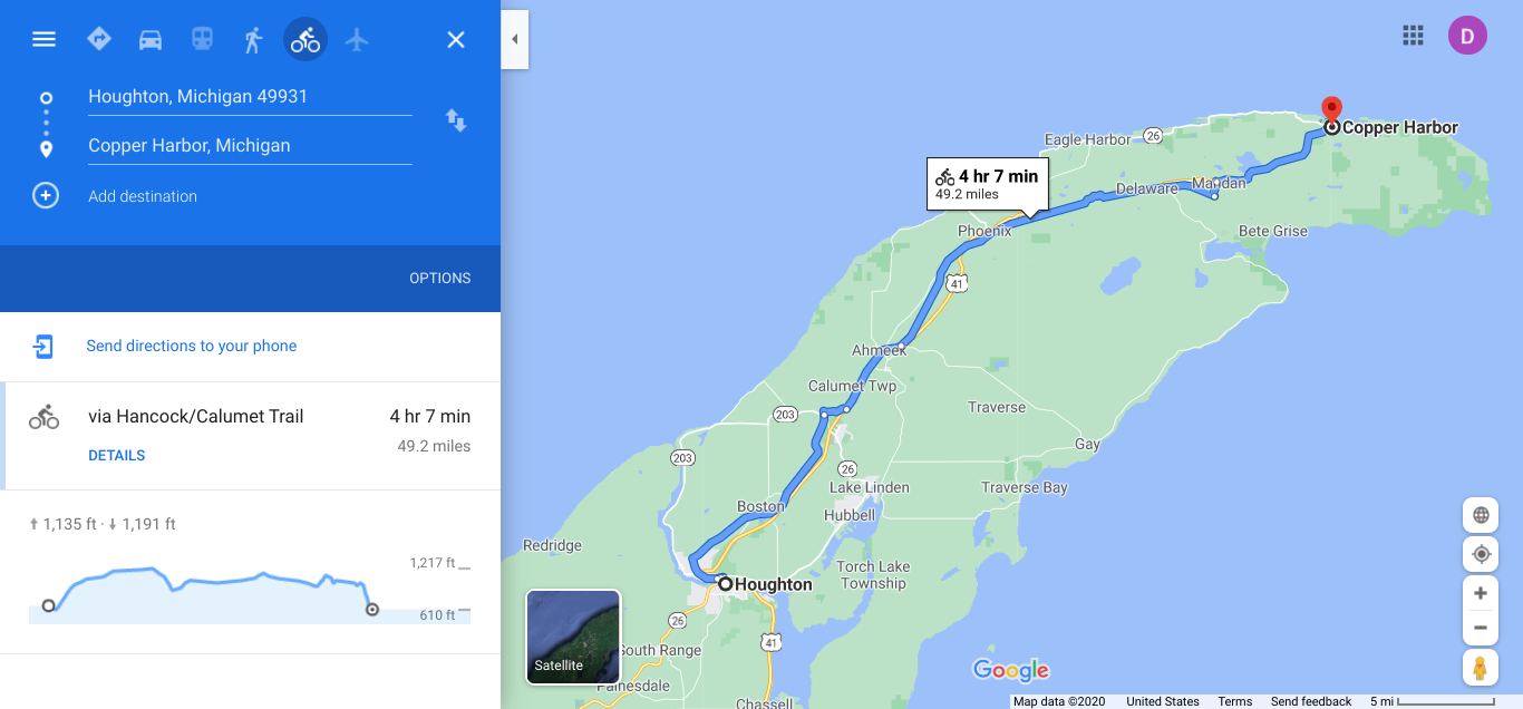 I decided to head east and go along the eastern shore and come back by the US 41. 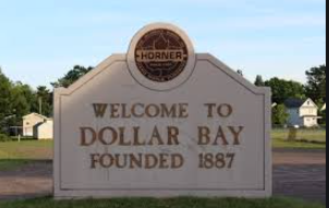 No one could tell me the story behind the name.  Dollar Bay is a small inlet on Portage Lake that you see here. The far end of the lake was opened to flow into Lake Superior. 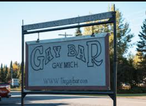 Some times you see a sign and just shake your head. 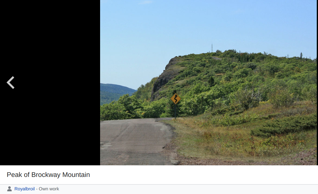 The Brockway Mountain Drive, 8.8 miles, has several nice vista spots to enjoy the scene. 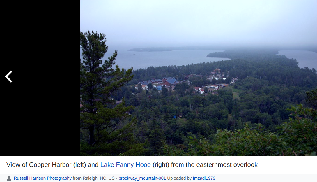 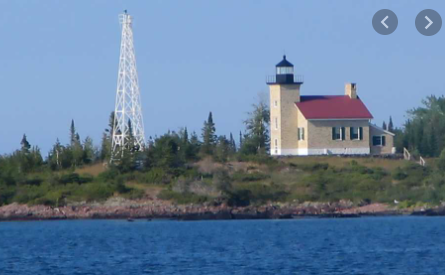 The Copper Harbor Lighthouse was built in 1866. 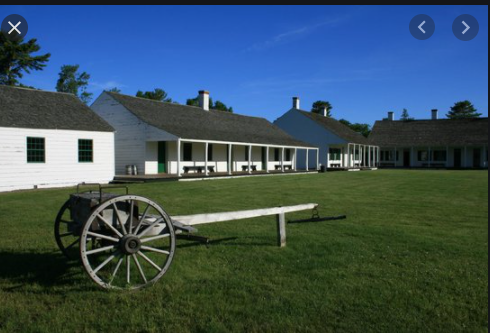 Fort Wilkins is a restored military post in a State Park. Originally built in 1844 to keep order in the area as the copper mining was booming. 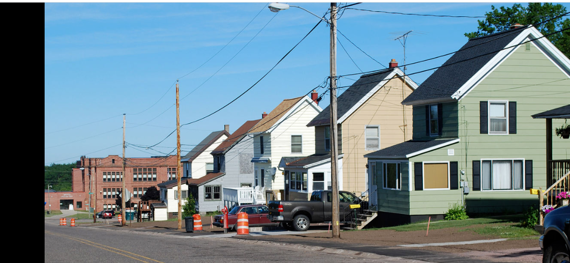 Painedale like many of the towns started because of the mining. This town named after William A. Paine who was part of this mine operation, but a founder of the Paine Webber brokerage. These saltbox houses are from the glory days.  A copper mine as it is going in the good days. 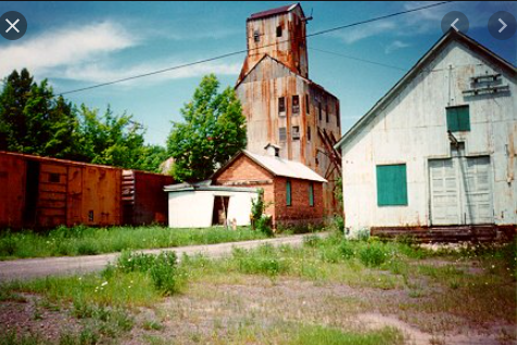 Through this area we see old shafts no longer in service. 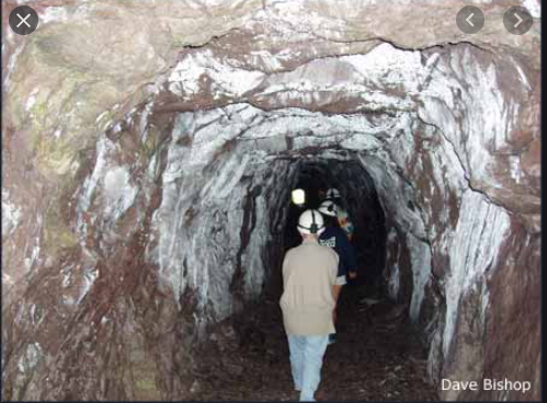 Some mines are open for a tour. 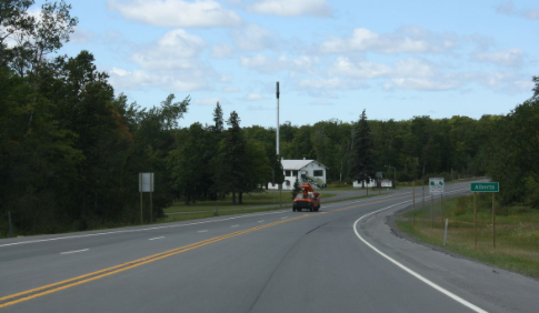 Moving out of the wilderness and on to the highway with a good road with a shoulder.  This area there is lake effect snow from the moisture picked up from Lake Superior due to the proximity. 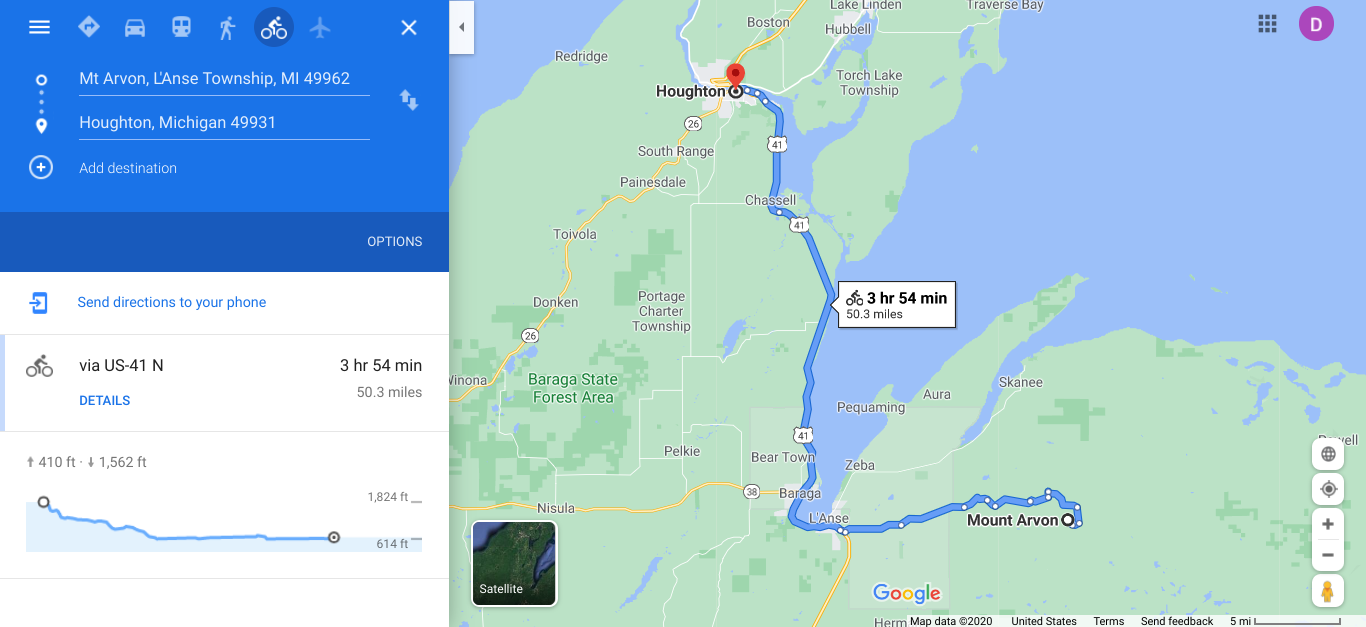 I am entering the Keweenaw Peninsula which is an obvious protrusion into Lake Superior when you are looking at a US map. 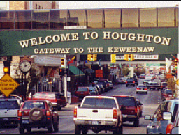 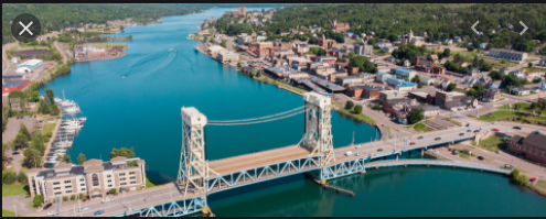 From my map it looks like there is a channel across the peninsula that would allow ships and boats to go across. This bridge span goes up to allow the passage of taller vessels. In research, I discovered that this is called the Keweenaw Waterway . It was first dredged in 1860 and has a depth of 25 feet. Locally the area north is known as Copper Island because it is not connected to the Upper Peninsula. Only way across is by US 41/ M-26. 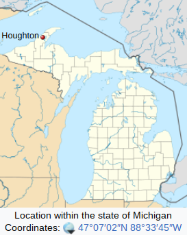 The dark line across the lakes indicates the border with Canada. The island in the upper left is Isle Royal, a US national park. 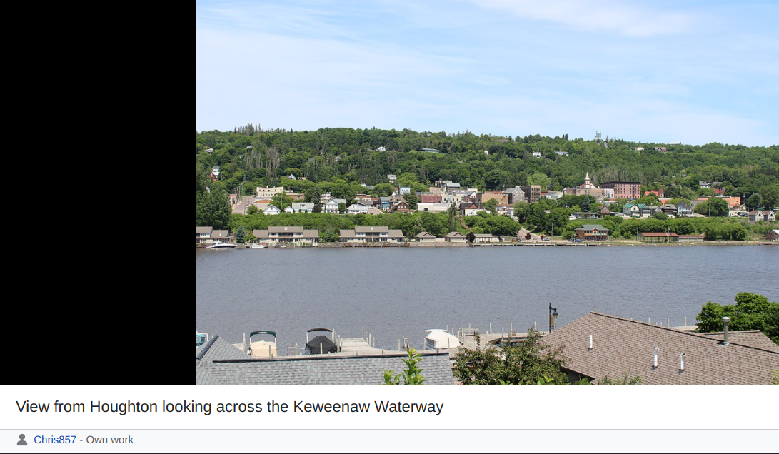 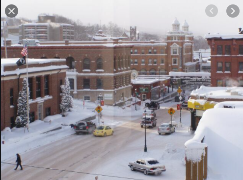 Hancock is consistently noted as the 3rd snowiest city in the US by The Weather Channel. |
AuthorI love my riding days and look to find interesting and informative items to share. 
Archives
October 2023
Categories
All
Pacific Coast Highway
MUP |
 RSS Feed