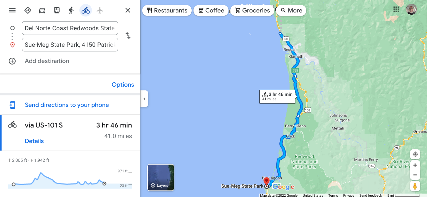
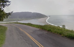
  The cars like the faster road and I like the road with a view. 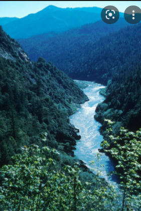 The Klamath River goes past Requa before it opens into the Pacific. Klamath River starts in Oregon and is the second longest river in California. In this area of the Pacific is a whale watching area. The fishing industry is big too.  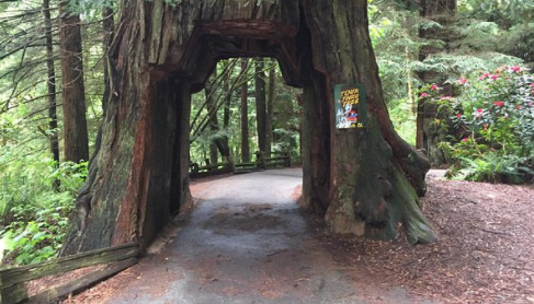 I remember friends when in elementary school that told about being in a car going through a big tree. This must have been the place. 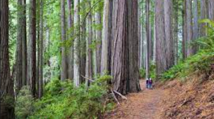 Exploring the Redwood National and State Park on the Berry Glen Trail. These trees are so impressive. For many years the redwoods were harvested and about 100 years ago organizations started taking preservation efforts. I was surprised to learn that the National Park was not created until 1968. There are many area close to enjoy this natural phenomenon.  Near Orick.  The beach at Big Lagoon County Park. 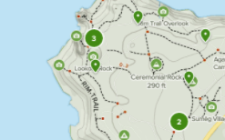 Sue-Meg State Park trails. The name of the park was Patrick, but it was renamed in honor of the the area had when the Yurok people lived here. In addition to the coastal redwoods, you will see Sitka spruce, hemlock, pine, and red alder. 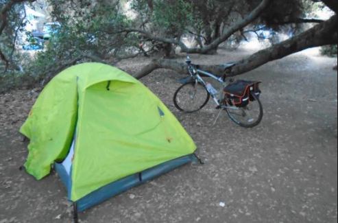 Hike and bike campsite. Many State Parks in California offer hike/bike campsite. Facilities are primitive and it is best to check ahead to get the specifics on the stop.  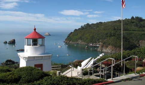 Picturesque Trinidad Inlet The first town was Trinidad. It is one of California's smallest incorporated cities with a population of 367. There are 10 public beaches here and you see the off shore rocks in the photo above. The area is part of the California Coastal National Monument which run along the shore to protect the environment. 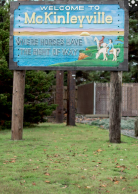 This community incorporated several smaller settlements.  I like to check to see what these areas offer.  I am glad to take the time to explore the McKinleyville area.  The air off the ocean was refreshing today. 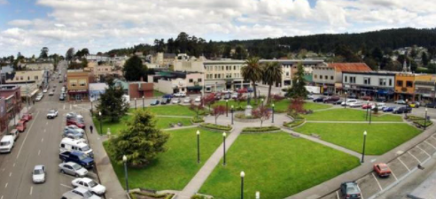 The plaza in Arcata is a hub of activity, surround by many shops and places to eat. 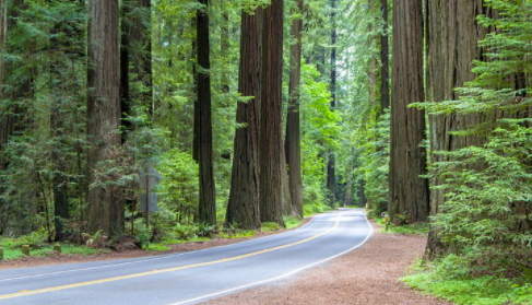 Heading to Eureka. Eureka is a city of 25,000. It is the largest port town between San Francisco and Portland. It is also a deep sea port, the only one between Coos Bay and SF. If you love Victorian homes, you will love this place. The Sequoia Park Zoo sounds interesting too. 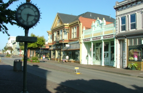 The old town section of Eureka. This is a good rest day spot. 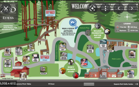 Sequoia Park Zoo.
0 Comments
  Near Ophir.  Store in Nesika for a snack and stocking up. 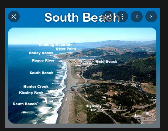 Near Gold Beach there are many beach options. 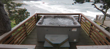 People ask what I think about when I struggle on the trip. 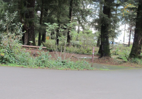 No hot tub tonight. Camping at Harris Beach S.P. 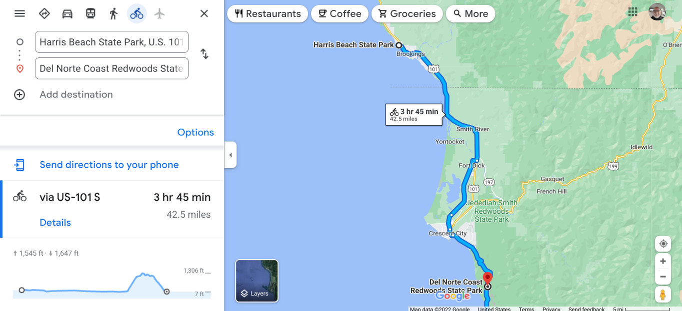 Saying goodbye to Oregon and into California. 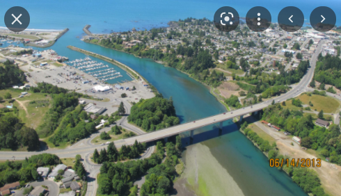 Brookings, Oregon Brookings was begun by the lumber industry and the city is named after that company that started lumbering the area. In 2011 a tsunami of an 8' wave damaged the harbor. The tremor that created the wave was from a quake near Japan. Astounding. 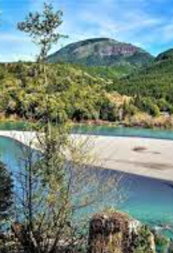 Mt. Emily near Brookings Mt. Emily is the only site on the mainland U.S. that suffering attack during World War II. A plane with torpedoes took off from a Japanese submarine and luckily there was no damage. I bet the waters were patrolled by the U.S. Navy. 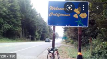 I look forward to my last state on this route, California. It looks to be a very long ride to Mexico. I spent a month moving my mileage through Oregon. I can see how the towns along the way are similar to the one along the Lake Michigan - Michigan shoreline. The areas that sustained themselves had a river outlet. Lumber, fishing, and recreation developed the areas. 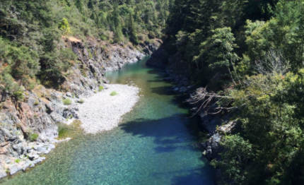 Looking down into the Smith River. 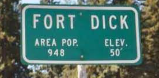 I did not see any evidence of a fort.  This city is the only incorporated town in the county. It is named for the shape of the sandy beach. 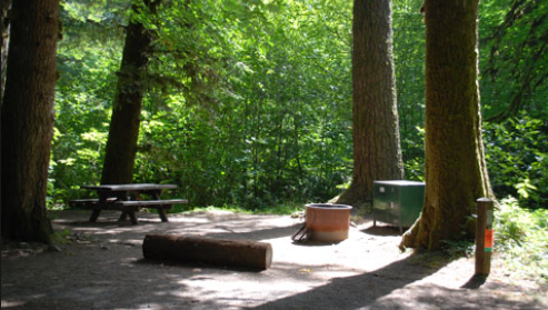 Campsite in Del Norte Coast Redwoods S.P. In the photo you see a steel bear box. Be sure not to keep anything in your tent that will attract a bear. The trees are astounding! 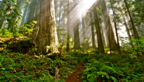 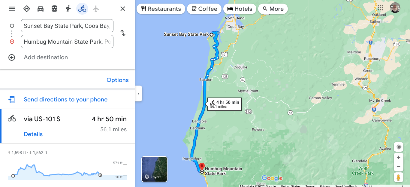 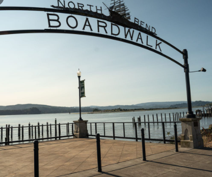 On my way to Sunset Bay I stopped at North Bend and then cross the bridge at the bay opening. 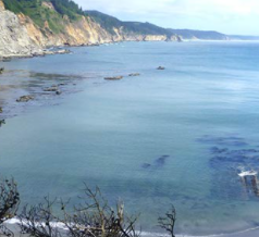 I need to catch my breath and I enjoy the view. 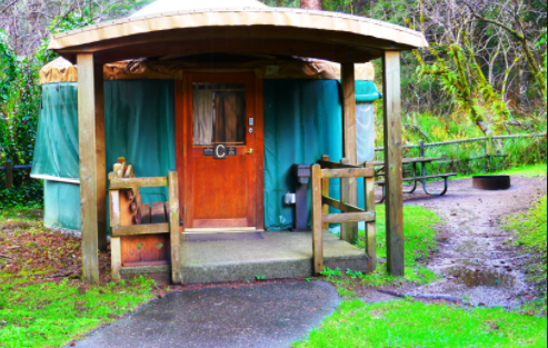 A yurt in Sunset Bay S.P. and from there I went to explore the Coos Bay area. 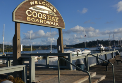 Another nice place to walk. The breeze off the water is so fresh. 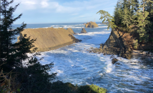 I am back by the ocean. 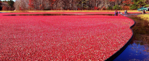 Cranberries in Bandon. There is a big festival yearly. The area's first European settlement was in 1853. Some twenty years later George Bennett decided to name the town after his Irish hometown, Bandon. I guess he was homesick. In my travels, I have noticed that this is common with many US towns. My hometown of Rochester, MI was settled by people from New York state. I should not be critical. I bet that I would do the same thing.  In the town of Langlois has a treasure. Be sure to read the guidebooks when you travel. Langlois was named after an early settler and that is a common way of naming places too. By the way, it is now pronounced lang-loyce, as in Joyce. I said lang-loy as in toy. They can always tell that you are from out of town by mispronounced local names. I don't think that they noticed my panniers and ragged look. 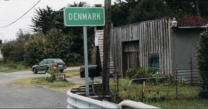 I wonder where these settlers were from originally. 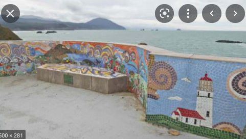 What a fancy spot to enjoy the view. Port Orford is the western most settlement in Oregon and in the contiguous 48 states. 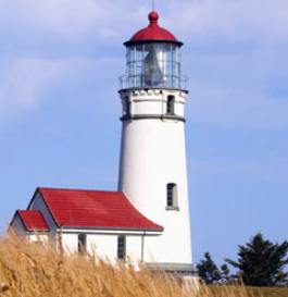 Cape Blanco Lighthouse. This lighthouse is the oldest in the State of Oregon and tours are available.  Another State Park for overnight. This virtual bike tour has covered 681.7 miles so far.
Beverly Beach State Park to Sunset Bay State Park (near Coos Bay) 113 miles. Total 596 miles 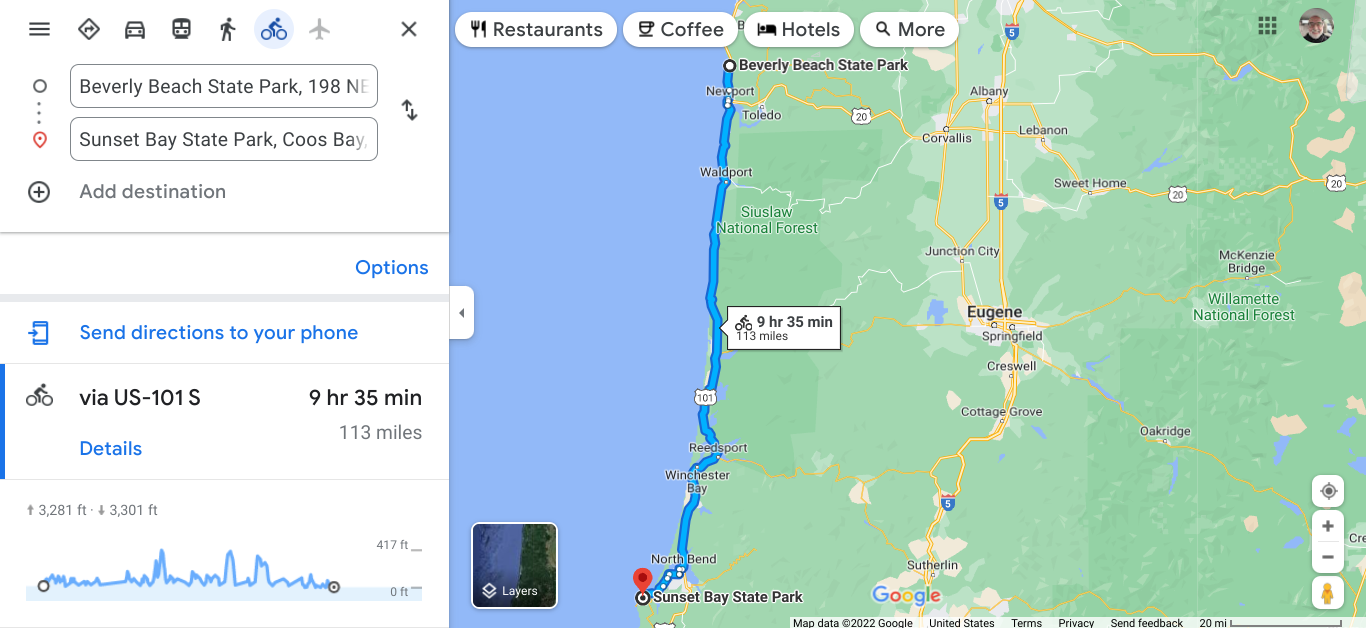 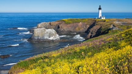 Yaquina Head Lighthouse. At 93', it is the tallest lighthouse in Oregon. It was made in Paris and shipped here for installation in 1873. Guided tours are available. There are 11 lighthouses along the coast. This is the first that I have seen on this tour. 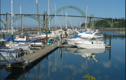 The Yaquina Bay Bridge from the RV Park and marina. The bridge is known as one of the most distinctive along the Pacific Highway. It opened in 1936 and its overall length is 3260'. 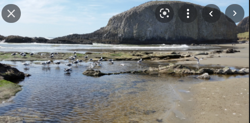 Seal Rock State Recreation Area. 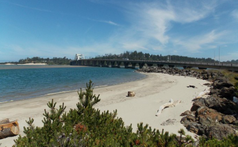 Near Waldport the Alsea River comes out to form this bay. 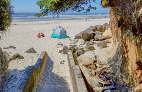 Tillicum Beach State Park camping. 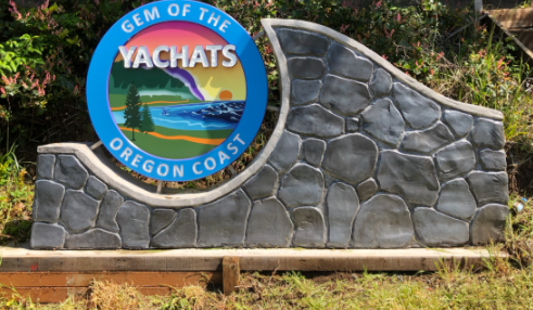 Yachats gets high marks as a destination area for tourism, but lumber, fishing, recreation and food products also are strong in the economy. 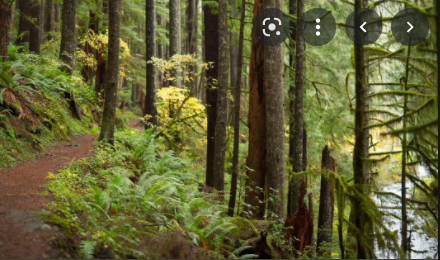 The Siuslaw National Forest has many trails. 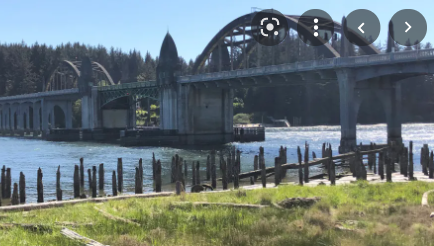 The Bascule Bridge in Florence. This bridge design looks very familiar. Create a space large enough for the boats and ships to pass under. 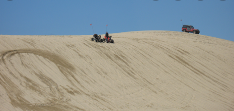 Dunes City reminded me of the dunes we have along the western shore of Michigan. 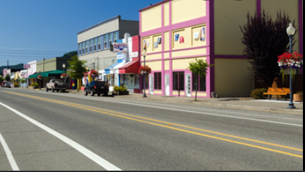 Going through Reedsport. The sign announces Gateway to the Dunes. Reedsport, like many of the larger towns along the US 101 are at a mouth of a river ; in this case, the Umpqua River. The town is home to an office of the US Forest Service and a Discovery Center with displays of the area. 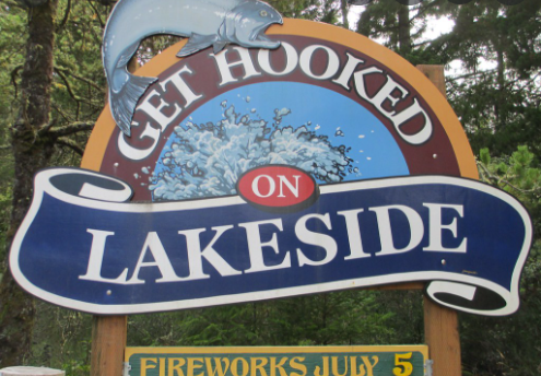 The next town was Lakeside. Easy to find a place to eat, rest, resupply. 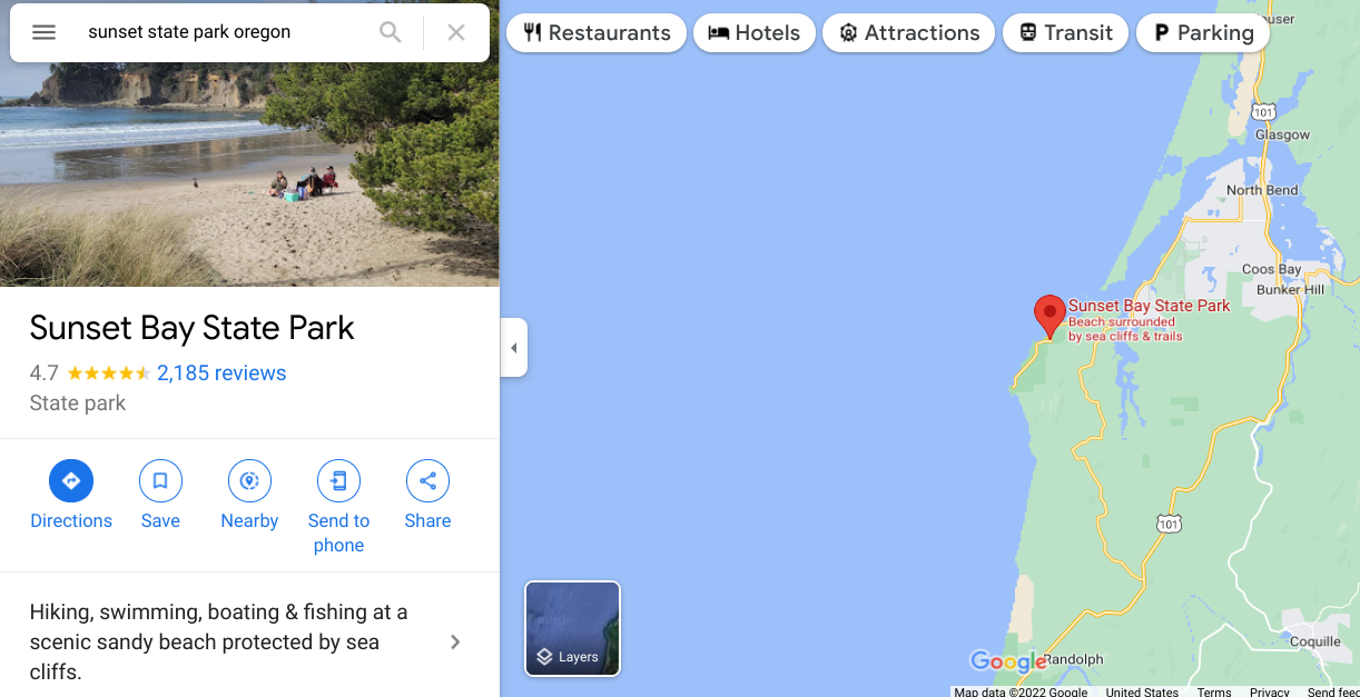 This looks like a good place to take a break. Laundry needs to be done. |
AuthorI love my riding days and look to find interesting and informative items to share. 
Archives
October 2023
Categories
All
Pacific Coast Highway
MUP |
 RSS Feed