|
Photos of this trail with tunnels and trestles always caught my attention and lead me to want to bike there. A friend told me that he went on a Roads Scholar trip on this trail and others in the area. I am concerned with my ability to handle the elevation. I might be able to do it with an e-bike, but I am not sure. During a trainer ride last week I followed along on a YouTube video that someone did. 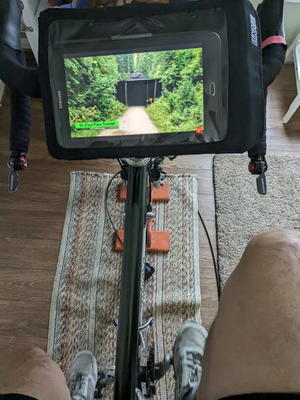 The first tunnel was closed for safety reasons. Okay, I am good with that. 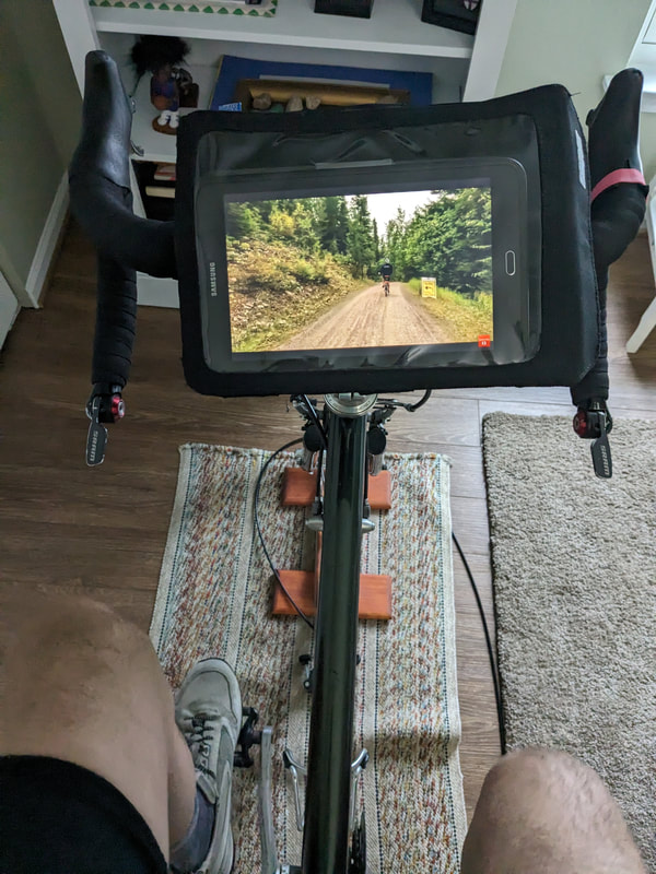 Railroad grades are good for me to ride, the elevation is 2188'. I could probably handle it. 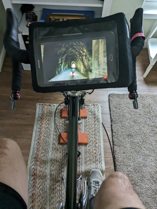 These tunnels are longer than what I am used to. Bring a headlamp. 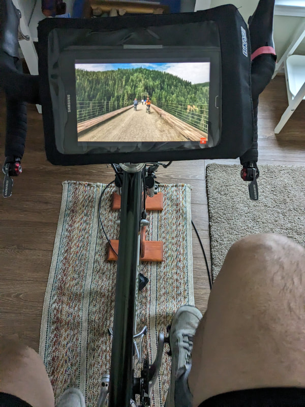 A nice wide path to stop to take a photo and enjoy the pine forest. 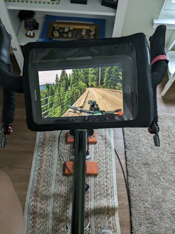 There is a fee to ride the trail and there are shuttles to take you back to your car. There are several videos of riders doing the trail. I enjoyed this ride and I will look further into this trip through Road Scholar. 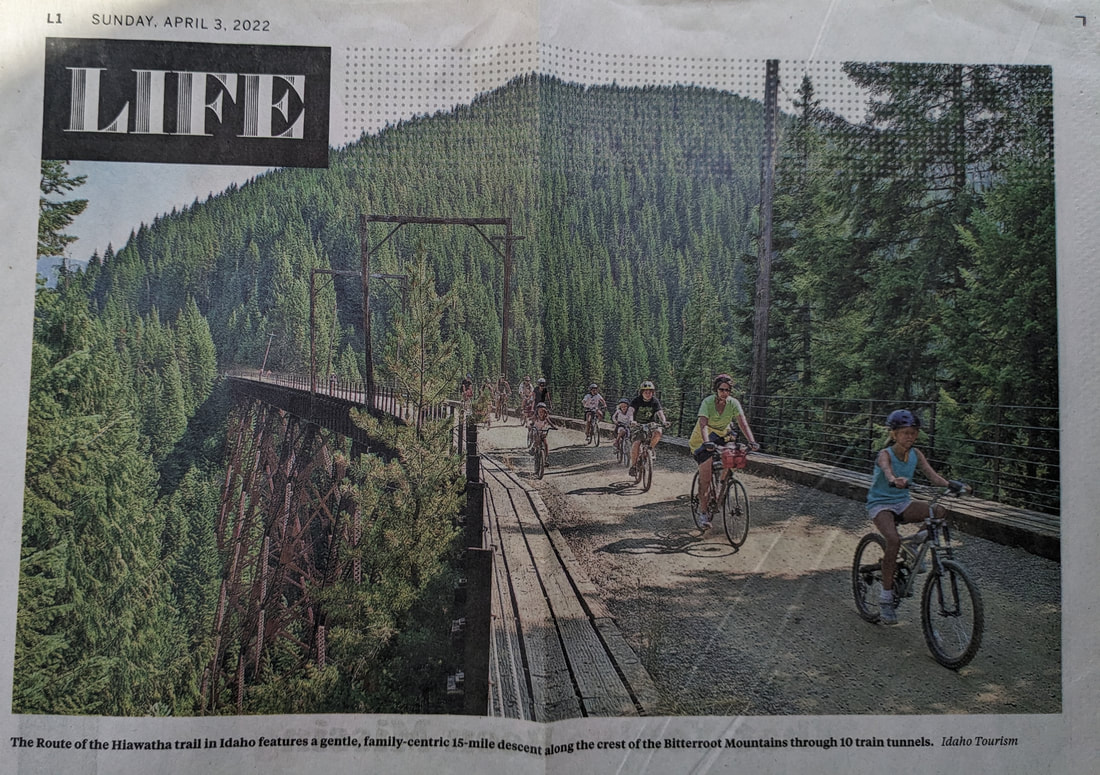 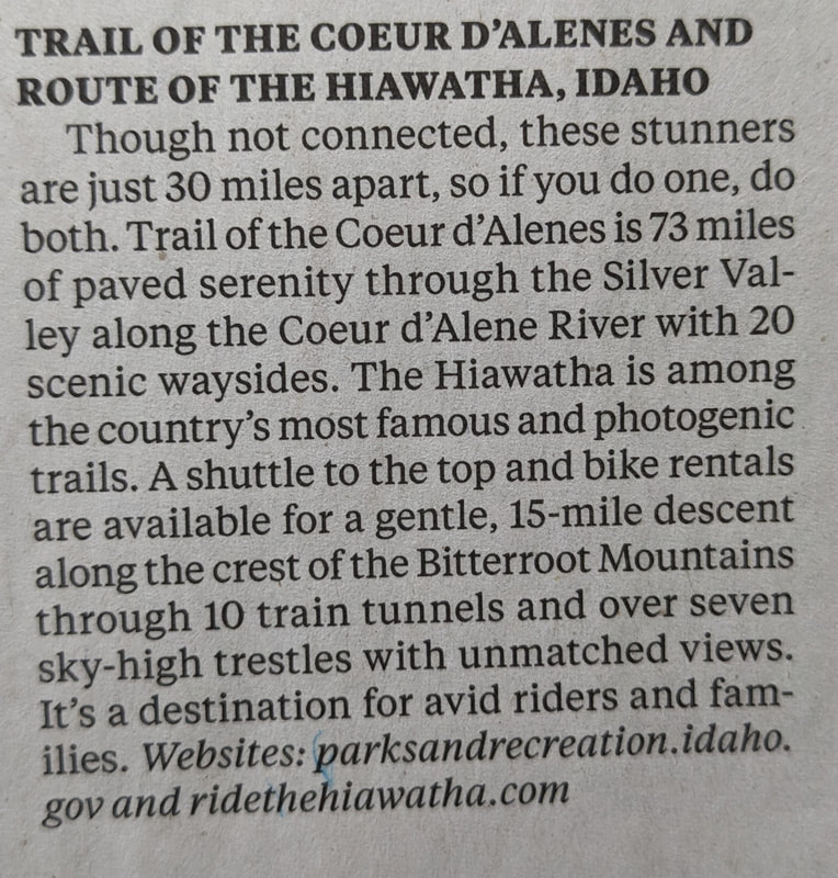
0 Comments
When I started touring again in 2011 and was getting my gear list together I happened to see a foldable canvas stool that was about 18 inches off the ground. That is about the stand chair height. I just measured my dining room chair. It folded flat and would set right on top of my rear rack during travel.  Rough sketch of the set and bottom shows the flat folder view. This chair worked well because it was very compact and it did not weigh much. Most of the time there is a picnic table when you get a campsite. I know from experience you don't always get a table and then I would sit on the ground. I appreciate being off of the ground. I am getting to the age that this is not as comfortable as it used to be.  Necessity is the mother of invention and we can always find something in our gear to sit on. It is nice to have a seating option during the ride and not just when you get into camp. This can smooth out those pointy objects that always seem to find those sensitive nerve sensors. Before an organized tour one of the riders asked the leader if it would be good to bring a chair. That question got me thinking about a more comfortable chair. The stool was functional but not the most comfortable. When sitting around the fire my back would get sore. I looked at the REI catalog and I saw a chair that I wanted to try out. The tour was carrying our gear from site to site and another pound of gear was not a problem. 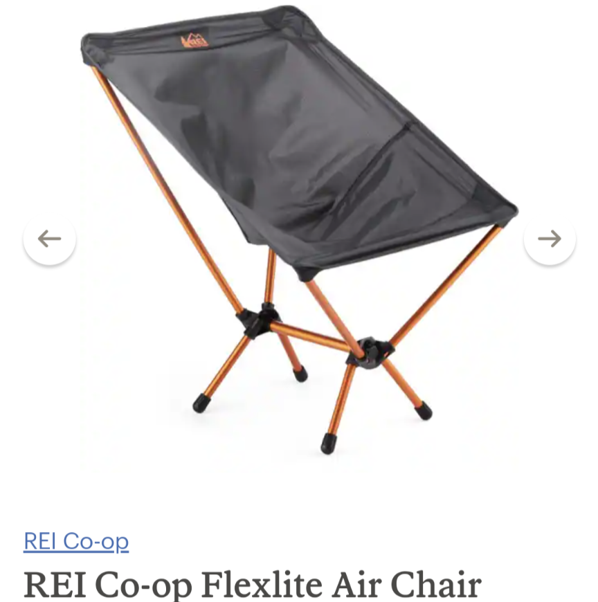 I have been very happy to take this along on my tours.
I started going to a chair exercise program at our local mall. This is led by the U of M School of Klnesiology Monday, Wednesday and Friday from 9-10 AM. This is just what I was thinking that I would like to do I have gone to two sessions so far. We begin with a half hour of stretching and resistance band workouts in and out of the chair. We then do 20 minutes of aerobic movement to elevate the heart rate. The last ten minutes is a warm down back in the chair. 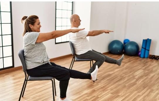 When I started working my arms I could feel the strain. Others could continue, but I kept taking brief pauses to give myself a rest. That is when I realized that I need to build some strength. 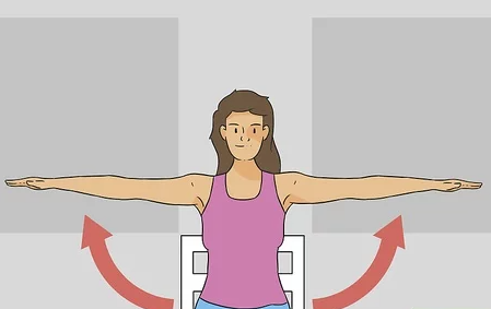 I will be working on arm movements that lift, hold in position and raise above my head. I will start out without added weight in my hands. Just the weight of my arms is enough of a challenge. I used to lift 2 to 5 pound dumbbells , but I quit doing that and I see the result of stopping that practice. I can do some of these exercises while I am on my stationary bike. I like to keep the hands on the bike while I ride the street. 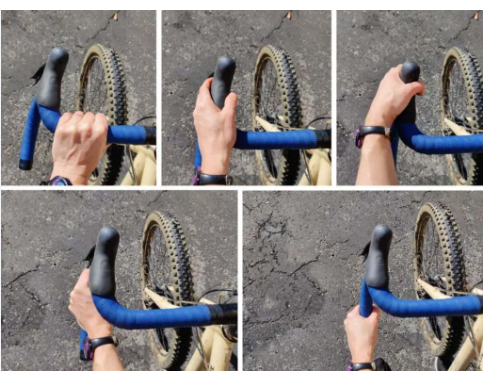 The need to build upper body strength makes sense for me. You can see the various hand positions that I have on the drop handlebars. The upper body strength that I have holds me up during a full day of riding. This was a wake up call for me to build up some muscles that do not get much use while I ride.
I signed up with Road ID just over nine years ago. I saw ads on my phone and thought that I would try it out . Most of the time I did not ride with any identification when I first started riding. Cyclists think they will not have an accident and won't have any mechanical. Am I right? After a while I traveled with a paper that had contact information of family members and my drivers license. Have you ever forgotten something on a trip? Me too. I sometimes still left home without any information. After about three years of riding I gave myself a Christmas gift. I wear it almost all the time. You do not know when first responders will need your information. 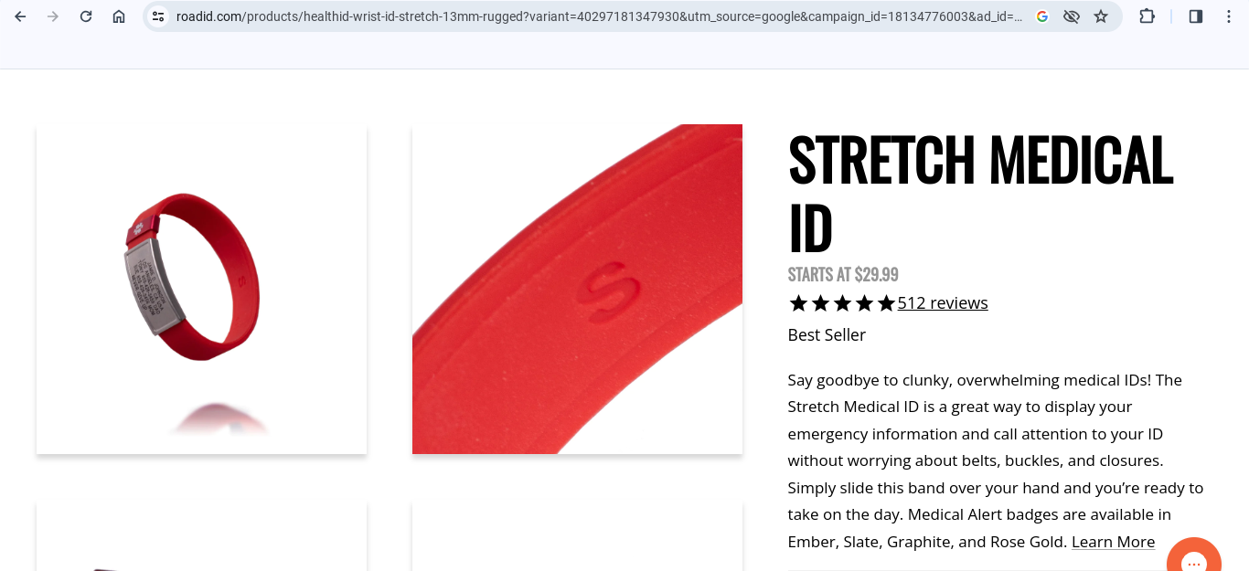 A screenshot of the Road ID website. The metal plate shows your name and any primary concerns and a Rode ID phone number and website. I identified health issues. On the inside of the band provide you are given a serial registry number and a personal identification number (PIN). 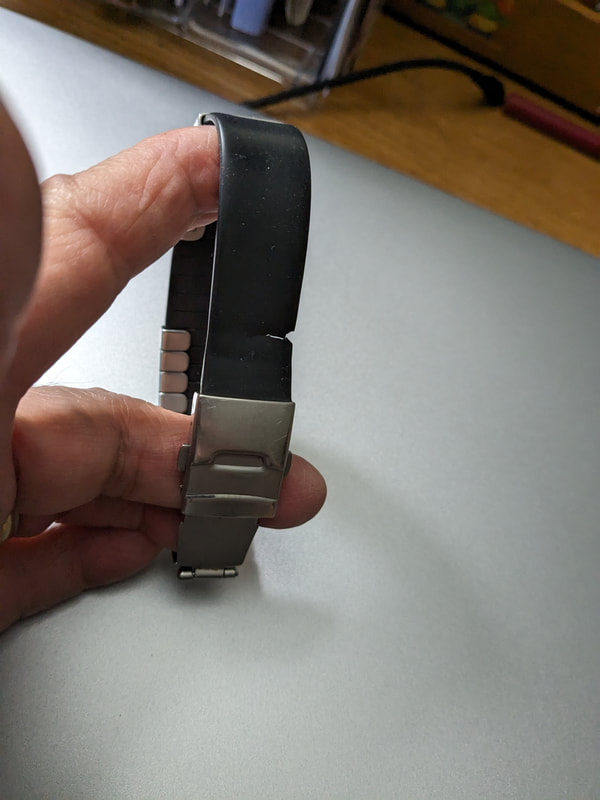 After nine years my band gave way. My band handled a lot of wear and tear. In the original order was a replacement band that is a supple at the original since it was stored in a plastic bag. The printing on the name badge is still like new. I had expected the ink to fade or wear, but no it has not.  Each year they offer new options and they now can work with the watch bands. Road ID provides a data base of your emergency information that may be helpful to rescue personnel. Who are you? Where do you live? Who are your emergency contacts? Are there any medical issues to be aware of? What medications are you taking? There is a very detailed template that is easy to complete and update. 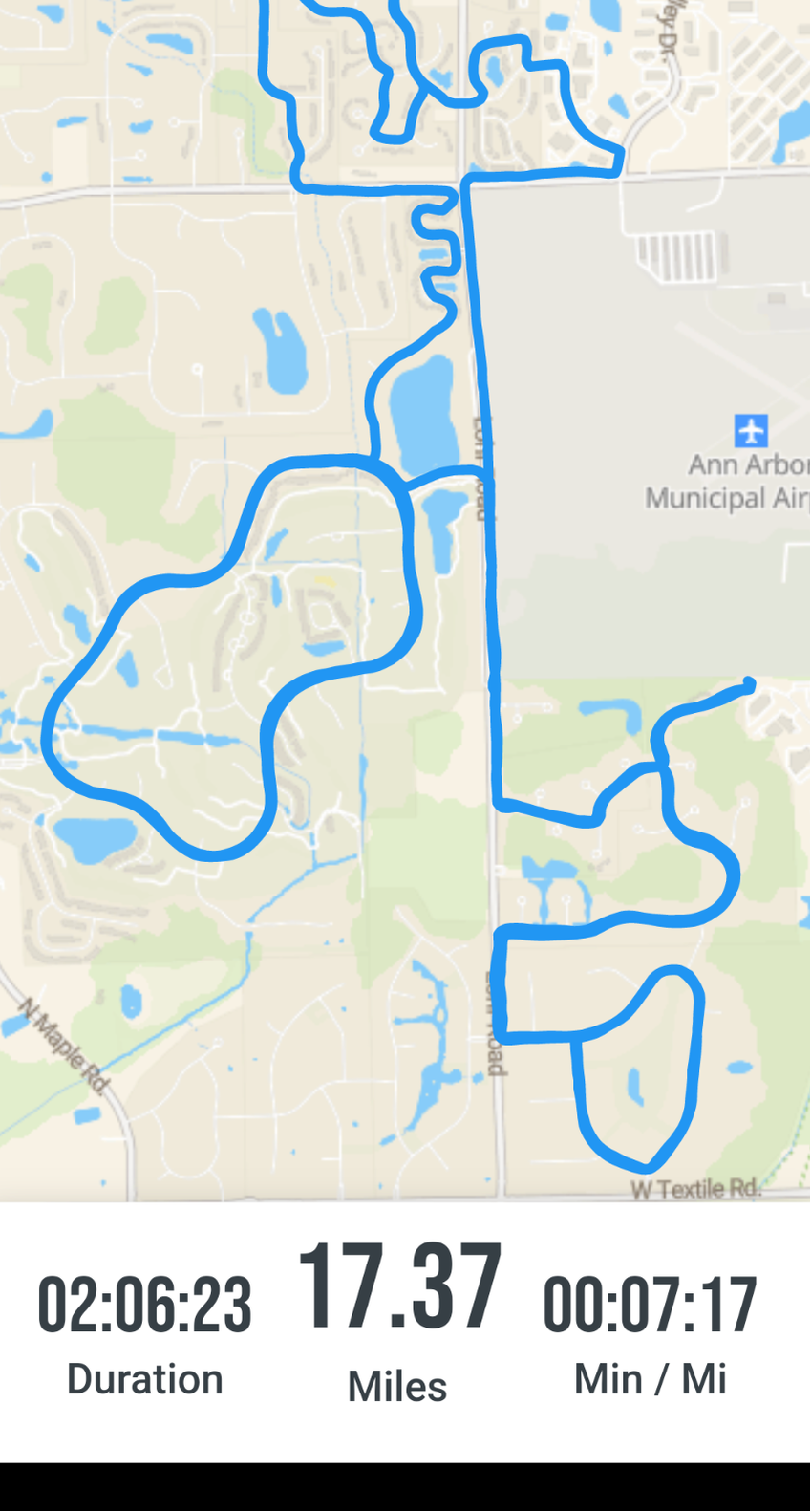 A map of a recent ride from the Road ID app. A few years ago Road ID started offering a ride tracking feature. This is a separate subscription from the badge purchase and subscription. The tracking app refers to itself as ecrumb. I can list five people to follow me on my ride and receive alerts when there is a problem. There is also a feature that contacts 911 and your friends if you are not moving for 5 minutes. That is in case I ride into the ditch. This feature gives you a loud alarm to "wake you up" before the panic calls go out for your rescue. This feature may be turned on or off by you. The GPS in the app gives your location. 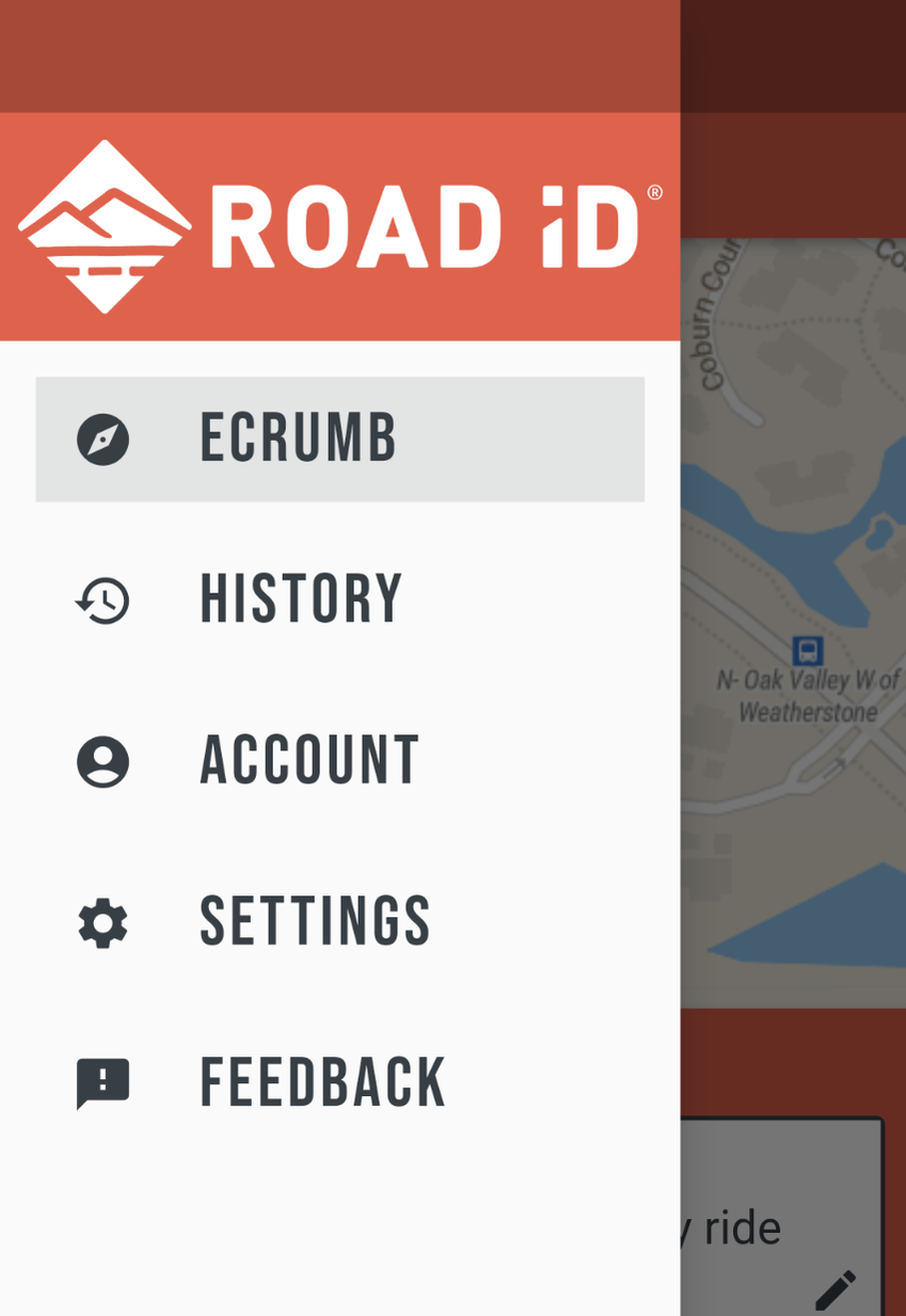 At the beginning of the ride my "followers" get an alert of my start and location. During the ride they can see where I am. Most of my ride path changes occur as I pedal and with this app I can rest assured that they will know where I am located. Be aware that any signal may get dropped, so I still leave a basic bike path plan with one of the followers. While I am riding I will text home with my location as it would be helpful. Sometimes the program crashed and I did not realize it until I stopped. 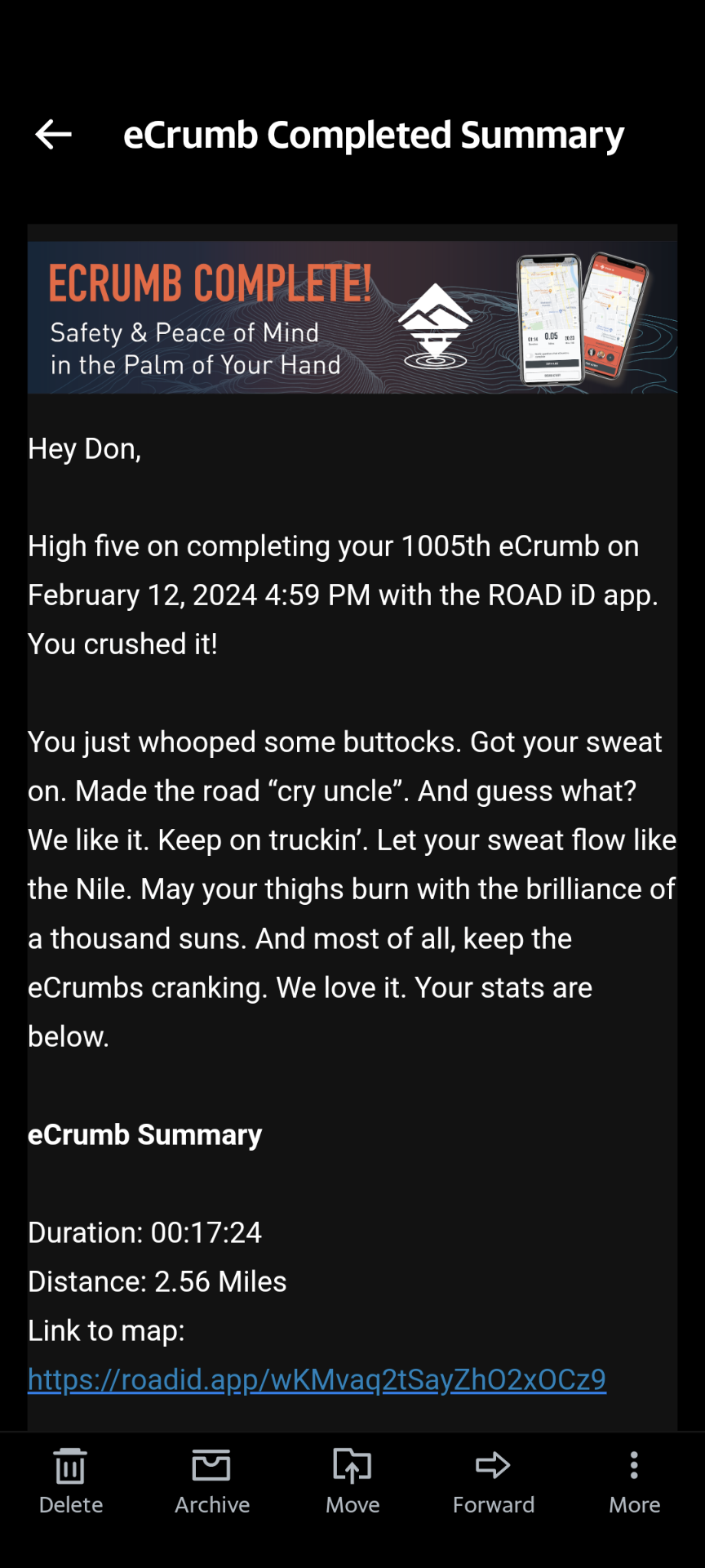 When I stop the ride an email is sent to my followers. They can see that I am ok and I will be packing up. 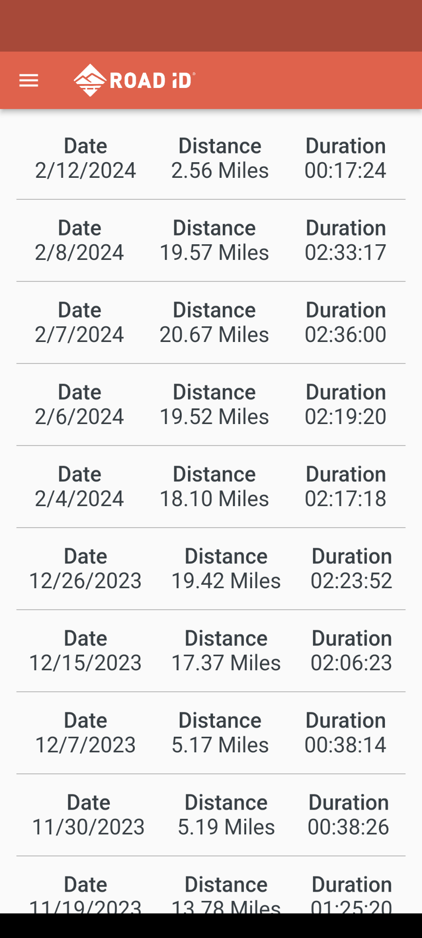 This is the log of my most recent rides outside. Did you notice on the email notice above that was my 1005th ride on ecrumb? I can go back and see the route and all the data on that ride. That is nice.
I have been very pleased with this feature. You may wish to check it out. This last week of unseasonably temperatures sure gets me a case of spring fever, but we are not yet to Valentine's Day and cold temperatures will be here again in Michigan. It is tricky to find the right combination for your core and once you find that are you set? I thought so, but I found that after an hour my hands and feet would be uncomfortable. This makes sense and I remember many hikes during Boy Scouts that my feet and hands would be cold on the hike. My first remedy was to use what I had already around the house. For my gloves I used the gloves that I used for snowboarding, cross country skiing, or snowshoeing. The wind against the hands on the bars may be a little too exposed to the wind. I could use an examination gloves or food service glove as a wind barrier. These items may not be the most flexible digits to work any levers. My go to winter street ride bike was my single speed cruiser.  Your bike shop or online will provide a variety of options for your hands that provide greater dexterity. Test rides will give you guidance for what you are looking for to best meet your needs. On my feet I used my insulated boots. These were plenty warm and worked well when there was snow on the ground. The wool socks were perfect too. I changed my pedals to the flat style. 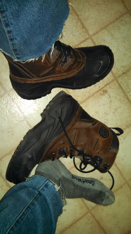 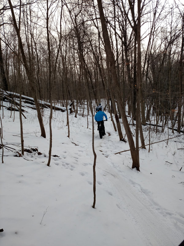 A fun ride along the groomed trail What type of riding would you like to do in the winter? Will you be out on roads, trails, paved or dirt? Will you enjoy it? Will you do enough to justify the costs? Will the temperatures need me to cover exposed skin? What organized rides are available? Do I want to take a break from cycling and enjoy a winter sport?
Last spring I purchased a Garmin Instinct Watch. This is not the top of the line, but I was mainly looking for a heart monitor and something that would sync with my Strava and may work with other apps that I may add later. I also saw that the watch had application that I may use once I become more familiar. This segment will focus on the heart monitor. 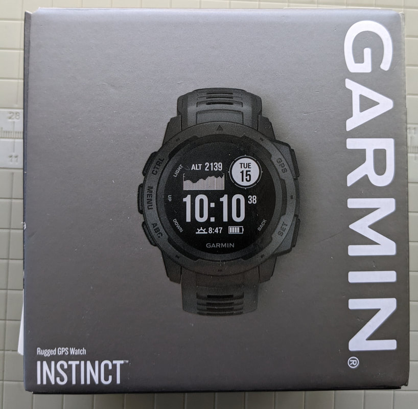 My heart rate is constantly monitored. I have the app on my phone and this gives me a report. While I ride I just look at my watch to see the current heart rate. I really never had any sense of my heart rate during the day. When I went up stairs, walked too fast, pedaled up a long or steep hill I knew my heart rate was high. In those situations I would know that I needed to stop or slow down to lower my pulse. 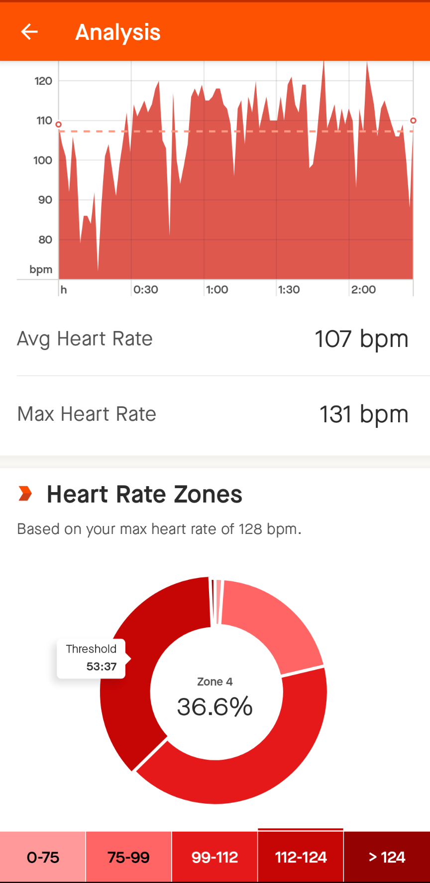 Zone 1 Zone 2 Zone 3 Zone 4 Zone 5 Basically resting Recovery Tempo Lactate threshold Anarobic The watch determines the heart rate zones shown at the bottom, which are based on the personal info put into the program. This is the report from my outside ride yesterday. When I saw the report for the first time I realized that I was pedaling too hard for too long. No wonder I was exhausted after some rides. During my rides I will now glance at my display to see how I should adjust by effort. This has helped to manage my energy on long rides and to keep from dipping into the highest zone which can quickly put you out of wack for later in your ride. Do you ever remember saying, " I went out too fast." This information can help me plan my next work out. For example, today I might take it a little easier since it is early in the season. In a few months I might say that I want several sessions at this level to simulate a multi-day tour where I would be expending more energy through a longer period . Right now I am maintaining my base while I wait to go outside daily. 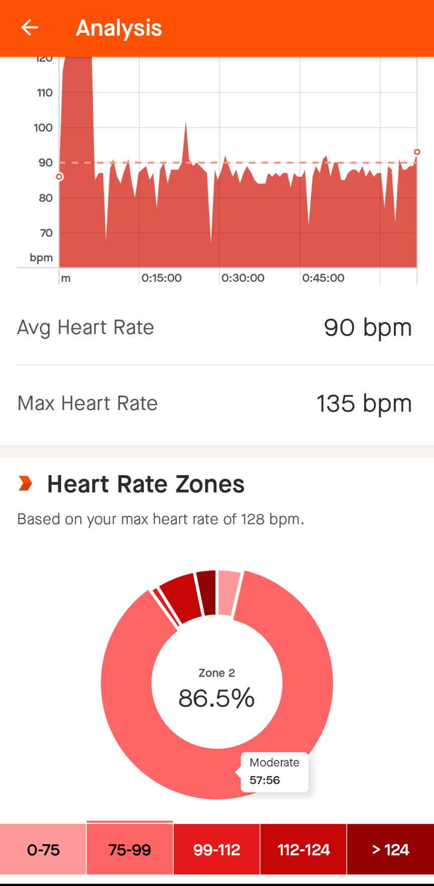 Here is a session on my trainers. I find it easier to maintain a steady heart rate. In this moderate zone I can really go all day. At that pace the cycling feels effortless. Most days inside at this time of the year I try to go slow and steady.
Do you monitor your effort on rides? How do you adjust? You may not. I did not worry about it when I was younger. I pay more attention now at my age. I am sure that riders in race training mode are more sophisticated in their training. I am just out for the fun, but I want to be able to ride my week long tour planned for this summer. |
AuthorI love my riding days and look to find interesting and informative items to share. 
Archives
October 2023
Categories
All
Pacific Coast Highway
MUP |
 RSS Feed